Monday, March 9, 2020

Bear Grub Timber Sale: A Threat to the Forests and Communities of the Applegate Valley

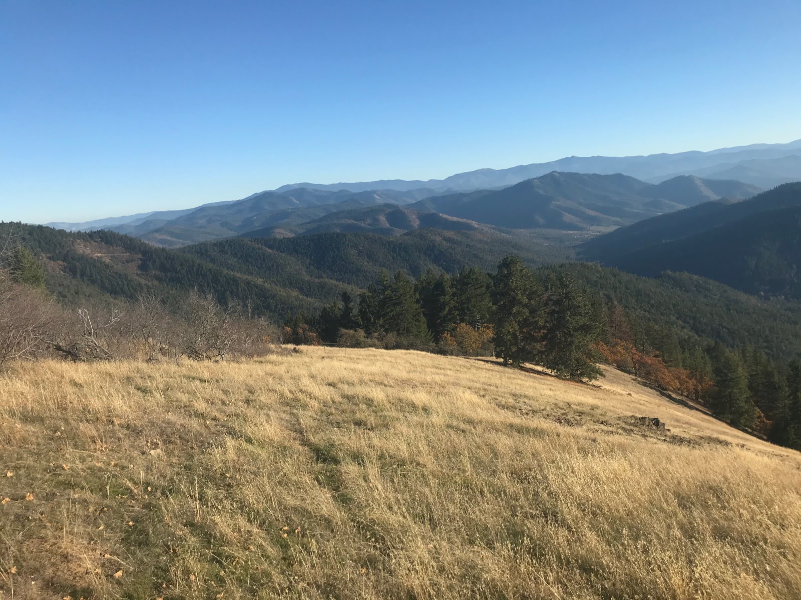
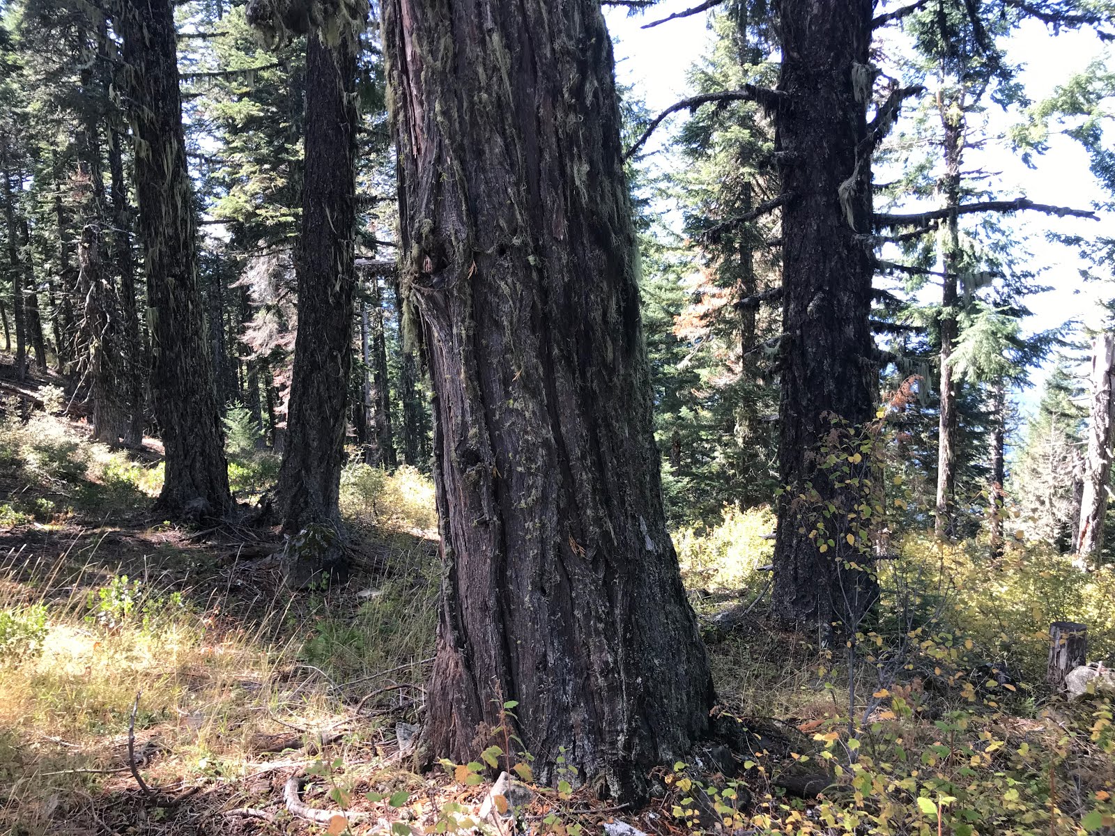
Unit 13-1 directly below the East Applegate Ridge Trail contains open, fire resistant forest dominated by large, old trees.
The Medford District BLM recently proposed a new timber sale in the foothills of the Applegate and Rogue River Valleys within the rainshadow of the Siskiyou Crest. The arid forests targeted for logging in the Bear Grub Timber Sale are the driest forest habitats in Western Oregon. Although designated for timber production, as "timber harvest landbase" by the Medford District BLM, these forests simply cannot sustain the level of logging proposed in the Bear Grub Timber Sale while still maintaining important social and biological values. 

Biodiversity & Wildlife

Large trees marked for removal in unit 13-6 along the East Applegate Ridge Trail.
Found within a larger mosaic of chaparral, oak woodland, hardwood forests and arid grasslands, the forests of the Bear Grub Timber Sale are extremely important for their habitat values, connectivity and biodiversity. The area supports a unique assemblage of Pacific Northwest, California foothill, and Great Basin species found nowhere else in the state of Oregon. 

The forests of the region support endangered wildlife such as the Northern spotted owl and Pacific fisher, significant populations of the Great gray owl, and more common species such as black bear, cougar, coyote and large herds of black tailed deer. The region's mature, closed canopy forests provide nesting, roosting and foraging habitat for the Northern spotted owl, denning and resting habitat for the Pacific fisher, nesting habitat for Great gray owls, and thermal cover for a variety of wildlife species. 
Unit 14-2 in the lower Poorman's Creek watershed and within the viewshed of the East Applegate Ridge Trail has been marked using a group selection prescription. All trees in this photograph would be removed despite the open, resilient stand conditions.

In the Bear Grub Timber Sale the BLM has proposed to fragment and degrade mature forest habitats with "group selection" logging. This includes many acres of mature, closed canopy, fire resistant forest and the last unlogged forests in the Bear Grub planning area.

Group selection logging would allow the BLM to clearcut numerous blocks of mature, closed canopy forest, up to 4 acres in size, in each timber sale unit. These staggered clearcuts can account for up to 30% of a given timber sale unit, dramatically altering the forest composition and structure, fragmenting forest canopies, reducing late successional habitats and dramatically increasing fire risks. 

Community Fire Risks

A group selection unit implemented in the 2014 Sterling Sweeper Timber Sale in the Little Applegate has filled in with dense, young growth and has transformed formerly cool, shaded forest into a hot, windy environment more susceptible to high severity fire following past logging treatments.


The Bear Grub Timber Sale proposes to remove whole groves of large, fire resistant trees using group selection logging "prescriptions." This will convert cool, shaded habitats into dry, windy environments more susceptible to high severity fire. The increased sunlight and wind penetration will dry forest fuels, increase wind-driven fire events, and create an overabundance of young, highly flammable vegetation. Canopy gaps created by group selection logging will respond by regenerating abundant woody trees and shrubs, increasing both fuel loads and fire risks. 
 
A whole grove of fire resistant trees marked for removal.

In fact, according to BLM management guidelines, if group selection openings do not regenerate into highly flammable thickets, they will replant them with young, highly flammable and commercially valuable conifer species.  

Recent environmental analysis in the BLM's Griffin Halfmoon Timber Sale near Hyatt Lake and the Clean Slate Timber Sale near Selma, demonstrates that similar logging proposals have been shown to increase fire risks in Southwestern Oregon. According to the BLM, following logging treatments these stands, "could exhibit higher flame lengths, rates of spread and fire intensity. Fires started within these stands could be difficult to initially attack and control. For 5 to 20 years following planting, the overall fire hazard would increase" (Clean Slate Environmental Assessment P. 192, Griffin Halfmoon Environmental Assessment P. C-17).

The Bear Grub Timber Sale and its extensive group selection logging prescriptions will have similar effects; however, due to the significantly more arid growing conditions and slower conifer growth rates in the dry Applegate foothills, these fire risks could be more persistent on the landscape. This is particularly important because the entire Bear Grub Timber Sale is located within a Wildland Urban Interface and proposes to implement commercial logging treatments directly adjacent to homes and communities.
Fire resistant forest proposed for logging in the Wellington Wildlands.

If implemented as currently proposed, the Bear Grub Timber Sale will threaten hundreds of rural homes with additional fire risks in the Applegate Valley, as well as the communities of Talent and Phoenix in the Rogue River Valley. Although the BLM's 2016 Resource Management Plan requires them to implement activities in the dry forests of Southwestern Oregon that will reduce fire risks and increase fire resilience, it appears that the Medford District BLM has prioritized timber production over the safety and welfare of nearby communities. The Bear Grub Timber Sale will increase fuel loading, increase fire severity, increase fire risks and create significantly higher levels of future home and infrastructure loss during wildfire events. For these reasons alone, the Bear Grub Timber Sale should be canceled.

                                                  Impacts to Recreation
Trees marked for removal along the East Applegate Ridge Trail in unit 13-6 of the Bear Grub Timber Sale.
Group selection logging is also proposed along the extremely popular East Applegate Ridge Trail and Jack-Ash Trail. These relatively new trails were designed, built and funded entirely with community donations and grants and significant public support. As soon as the trails were built, hikers began flocking to the area due to its unusual combination of accessibility and extreme beauty. Local community members spent over 5 years working with the BLM to develop these trails and they have quickly become the pride of the Applegate Valley. They are also cherished by residents of the Rogue River Valley and tourists visiting the area.

These trails contribute significantly to the quality of life in the region, and ultimately the Applegate Ridge Trail and Jack-Ash Trails are proposed to travel over 80 miles, connecting the communities of Ashland, Jacksonville, Grants Pass and the Applegate Valley. Together these non-motorized trails would highlight the beauty of the Siskiyou Mountains and benefit nearly every community in the region. 
The East Applegate Ridge Trail winds down to Highway 238 on lower Poorman's Creek. The forest across the canyon is targeted for group selection logging in the Bear Grub Timber Sale.

In fact, the sections of currently developed trail on the East Applegate Ridge Trail and Jack-Ash Trail are already receiving extremely abundant use by hikers, equestrians and mountain bikers throughout Southwestern Oregon. The trails are heavily supported throughout the region and provide both a significant recreational draw and economic opportunity for the area. 

Despite widespread public support for these trail systems, the Bear Grub Timber Sale proposes to implement group selection logging adjacent to the Jack-Ash Trail and the East Applegate Ridge Trail. The timber sale also proposes units along proposed trail segments currently being designed as future additions to both the Jack-Ash and Applegate Ridge Trails. 

Wellington Wildlands
Looking down China Gulch in the Wellington Wildlands to the Applegate Valley near Ruch, Oregon.

While driving Highway 238 through the Applegate Valley you can't miss the numerous Save Wellington Wildlands signs posted across the community. Wellington Wildlands is a 7,527-acre roadless area located between Ruch and Humbug Creek at the heart of the Applegate Valley. An effort is underway to save the Wellington Wildlands from the Bear Grub Timber Sale, which proposes to commercially log portions of this ecologically important landscape and degrade its wildland characteristics.

Well loved and heavily supported in the region, Wellington Wildlands is a uniquely accessible, low elevation habitat with intact
oak woodland, chaparral, grasslands, and dry mixed conifer forests. It is also proposed as a central feature of the Applegate Ridge Trail between Jacksonville and Grants Pass.
 
A proposed timber sale unit in the China Gulch Watershed in the Wellington Wildlands.

11 commercial timber sale units have been identified at the headwaters of China Gulch in the Wellington Wildlands. These units contain stands of mature forest with scattered old-growth trees. Logging these stands will impact biological values, degrade Northern spotted owl habitat and reduce the acreage of this roadless area, dropping it below 5,000 acres by logging significant acreage. The units would also isolate nearly 2,000 acres from the eastern portion of the roadless area. If these portions are logged or severed from the roadless area, future protection of Wellington Wildlands will become far more difficult to secure. Please help us save Wellington Wildlands!

A Lack of Public Involvement 

Concern is also growing about the BLM's lack of transparency and failure to collaborate with local community members during the Bear Grub Timber Sale planning process. Currently the project is being planned behind closed doors and without speaking to those who will be most impacted. The BLM's Bear Grub Timber Sale represents not only a transition towards clearcut logging and increased timber production, but also a transition away from public collaboration and public involvement. 

Although this project surrounds many homes and communities, the agency has made no attempt to provide meaningful public involvement opportunities beyond the mandated scoping comment period. In fact, the agency has completely refused to meet with local residents to discuss this timber sale being marked in their backyards. Instead, the BLM is telling community members that they will only meet with them after official proposals have been solidified and the Environmental Assessment has been released, minimizing the public's ability to influence the project during the crucial early planning phase. 
Old-growth forest proposed for logging in unit 21-2 in the Bear Grub Timber Sale on the north slope of Bald Mountain above Talent, Oregon.

             Stop the Bear Grub Timber Sale!

The Bear Grub Timber Sale will threaten local communities with increased fire risks, impact important wildlife habitat and degrade recreational opportunities. The Bear Grub Timber Sale and its complete lack of meaningful public involvement reflects the policies of the Trump Administration trickling down to the local level, into our region and our forests. Public land managers at the BLM are now encouraged to avoid public involvement, expedite the NEPA process, minimize environmental analysis and emphasize resource extraction on public land. Its up to us to push back! Our forests and communities are not sacrifice zones! Please take action now to support the forests of the Siskiyou Mountains and the communities of Southwestern Oregon. You can help stop the Bear Grub Timber Sale!


Send a letter to the BLM and to elected officials in the State of Oregon sharing your concerns. The forests of the region need your help.

Send letters to: 

BLM Officials
Elizabeth Burghard, Medford District Manager
eburghar@blm.gov

Lauren Brown, Ashland Resource Area Manager
lpbrown@blm.gov

Elected Officials:
Oregon Senator Ron Wyden

Oregon Senator Jeff Merkley


The blue polygons depict proposed commercial logging units in the Bear Grub Timber Sale. The yellow polygons depict "potential fuel reduction" units.


Sunday, January 19, 2020

2018 Klamathon Fire Report: Natural Fire Effects, Unauthorized Wilderness Bulldozing, & Violations of the Wilderness Act


Pilot Rock rises above upper Hutton Creek in the Soda Mountain Wilderness Area. The 2018 Klamathon Fire burned through this area at low to moderate severity, reinforcing a spectacular mosaic of mixed conifer forest, oak woodland, arid grassland, chaparral and basalt outcrops.
Klamath Forest Alliance's Klamath-Siskiyou Fire Report Program has recently released the 2018 Klamathon Fire Report exploring the fire effects and unfortunate fire suppression impacts sustained while crews from the Oregon Department of Forestry (ODF) worked to suppress the Klamathon Fire. 

Some time has elapsed since the fire, and during that time Klamath Forest Alliance submitted a detailed Freedom of Information Act (FOIA) request in order to fully inform our investigation. We waited 10 months to receive the FOIA documents which delayed the release of the report. Unfortunately, the BLM did not provide all the documents we requested and many key documents were either omitted or redacted, including basic maps, forms documenting daily fire suppression activities, and other applicable information. Despite spending tens of millions of public dollars on fire suppression activities and damaging important natural resource values, the Medford District BLM has refused to be open and transparent about their activities in the Klamathon Fire. Yet, the information we did acquire demonstrates that significant violations of the Wilderness Act and applicable BLM management plans occurred. 

To view the whole report follow this link:

On July 5, 2018 the Klamathon Fire began as an escaped burn pile south of Hornbrook, California and rapidly swept through the small rural community, destroying 31 homes and tragically taking the life of an area resident who was fatally burned. 

California Governor Gavin Newsom declared a state of emergency, and for the first few days the fire burned with intensity through private ranch land and timberland. The fire jumped Interstate-5, forced the highway's closure and threatened many rural residential homes in the Colestin Valley. In just three days, the fire burned over 30,000 acres and sent large smoke plumes across the region.
The mosaic of low to moderate severity fire in old-growth forests on upper Slide Creek in the Soda Mountain Wilderness Area.

The Klamathon Fire then burned into the Cascade-Siskiyou National Monument and the Soda Mountain Wilderness Area; however, within these areas the fire had a much different character. It crept and smoldered in the backcountry, burning an ecologically beneficial, mixed severity fire mosaic. After reaching the Wilderness boundary, the weather moderated and the wind shifted, pushing the fire back onto itself. The change in weather conditions limited fire intensity and dramatically reduced fire spread.

As the fire spread more slowly into the Soda Mountain Wilderness Area it crossed the Oregon/California border, entering the jurisdiction of the Medford District BLM and the Oregon Department of Forestry (ODF), who implements fire suppression activities on BLM land. 

Dozerline was built in the Soda Mountain Wilderness and adjacent to the Pacific Crest Trail. This dozerline was built miles from the fire perimeter in old-growth forest and rocky meadow habitat.
Unfortunately, ODF aggressively attacked the slow moving fire, building an estimated 30 miles of bulldozed fireline and vehicle access roads into the heart of the Soda Mountain Wilderness Area. For six days, ODF bulldozed across the wilderness, opening old jeep tracks, destroying wilderness hiking trails and degrading the scenic values of the Pacific Crest Trail, all without proper authorization from the BLM. While conducting these unauthorized wilderness suppression actions, ODF badly damaged the wilderness qualities of the Soda Mountain Wilderness and the biodiversity values the Cascade-Siskiyou National Monument was designated to protect.

Although still a wild, beautiful and vibrant landscape, the untrammeled wilderness values were violated by ODF bulldozers and repeated motor vehicle use. The Cascade-Siskiyou National Monument remains a stronghold for biodiversity, connectivity and unique or rare plant communities, but some of the most intact, wilderness-quality habitats in the region were damaged during ODF fire suppression activities. 


A mortar and archeological site bulldozed in the wilderness.
ODF crews bulldozed east to west across the Soda Mountain Wilderness, building extensive vehicle access routes, helipads, hoist sites and safety zones. Wilderness suppression strategies such as Minimum Impact Suppression Techniques (MIST) were never implemented and bulldozers pushed straight through streams, springs, and riparian areas, rare plant populations, and Native American archeological sites. The BLM knowingly allowed these activities to occur without authorization, from July 6 to July 12, 2018, when they retroactively approved all wilderness fire suppression activities implemented by ODF. 
A massive "safety zone" bulldozed in the Soda Mountain Wilderness Area on the Salt Creek/Camp Creek Divide.

Populations of the endangered Gentner's fritillary were bulldozed.
For at least three months the Medford District BLM operated as if the Soda Mountain Wilderness Area was temporarily rescinded, or did not exist. During this time, the BLM and ODF violated the very idea of wilderness by building roads into the designated Wilderness Area and by allowing extensive non-emergency vehicle access. What occurred in the Soda Mountain Wilderness Area during and after the Klamathon Fire has seriously harmed the area's wilderness values and leads many to question the ability of both ODF and the BLM to manage public wilderness resources. The fire suppression actions taken were not implemented in accordance with BLM policy and were in clear violation of the Wilderness Act.

These unprecedented impacts associated with BLM/ODF fire suppression activities in the Soda Mountain Wilderness Area demonstrate a need for reform of fire suppression policies on Medford District BLM lands. ODF, in particular, has demonstrated that it is not qualified to manage wildfire in Wilderness Areas, National Monuments, Botanical Areas and other sensitive public lands, and its current fire suppression contract with ODF should not be renewed. 
 
The Lone Pilot Trail was bulldozed deep inside the Soda Mountain Wilderness Area and turned into a motor vehicle access route utilized by fire crews for three months after full fire containment. This photo shows a bulldozed stream crossing on upper Scotch Creek.

During the Klamathon Fire, BLM land managers failed to adequately protect public resources and public lands under their jurisdiction. Klamath Forest Alliance has submitted a request for an Inspector General Investigation and changes to BLM fire suppression policy inside Wilderness Areas. 


To view the whole report follow this link:
2018 Klamathon Fire Report

To read the Executive Summary:
Executive Summary
Vegetative recovery just months after the Klamathon Fire at the Horseshoe Ranch Wildlife Area.


Klamath Forest Alliance is the only regional environmental organization in the Klamath-Siskiyou Mountains actively working to reform fire suppression policy, document fire suppression impacts, and limit industrialized fire suppression activities in our most cherished wilderness landscapes. We promote progressive and effective fire management that restores the natural process of fire to backcountry areas, maintains wilderness habitats, reduces fire suppression related impacts, and protects human communities from damaging wildfire effects.


Vegetative recovery on Scotch Creek and in the Horseshoe Ranch Wildlife Area the spring after the Klamathon Fire in April of 2019.


Thursday, December 26, 2019

Klamath Forest Alliance, Siskiyou Field Office: A Year in Review

Klamath Forest Alliance works to protect the wildlands of the Klamath-Siskiyou Mountains.
At the Siskiyou Field Office of Klamath Forest Alliance (KFA) 2019 was busy and eventful. We advocated for conservation throughout the Siskiyou Mountains, opposing damaging federal land management projects and worked on policy issues surrounding fire and smoke in the state of Oregon. 

This past year we have worked on projects as diverse as the Siskiyou Mountains themselves — from the fog drenched forests of the Wild Rivers Coast and into the serpentine barrens of the greater Kalmiopsis Wildlands. We also worked in the the chaparral, woodlands and forest habitats of the Applegate Valley; the rocky high country of the Siskiyou Crest; the rugged canyons of the Klamath River; and the transition between the Siskiyou Crest and the Cascade Mountains in the Soda Mountain Wilderness Area and Cascade-Siskiyou National Monument.

We officially submitted substantial comments for five Forest Service projects and four BLM projects, including off-road vehicle developments and timber sales. We participated in two separate requests for comment for public land protections in Oregon. We also filed two administrative objections and one major lawsuit on Forest Service projects on both the Rogue River-Siskiyou National Forest and the Klamath National Forest.  

In 2020 we hope to expand our programs and do even more to protect the Klamath-Siskiyou Mountains and their world-class biodiversity! Please support our work!

  The Applegate Foothills
The Applegate Foothills contain a unique and highly diverse mixture of oak woodland, chaparral and dry conifer forest. They also contain extensive wildland habitats threatened by BLM timber sales, road construction and off-road vehicle use.

KFA has been monitoring multiple projects in the mountains surrounding the Applegate Valley. These projects include the Middle Applegate Timber Sale, the Bear Grub Timber Sale, the Late Mungers Timber Sale and the Upper Applegate Watershed Restoration Project.

   Middle Applegate Timber Sale
A view across the Wellington Wildlands to the Applegate Valley.
In 2018, the Middle Applegate Timber Sale was proposed by the Medford District BLM. The Middle Applegate Timber Sale included a vast planning area sprawling across the Middle Applegate Watershed. At the center of the planning area was the 7,527-acre Wellington Wildlands, a significant unprotected roadless area west of Ruch, Oregon. 

KFA immediately began working with numerous conservation allies to oppose the Middle Applegate Timber Sale and protect Wellington Wildlands. In the fall of 2019, after over a year of consistent campaigning by KFA and others, the BLM officially withdrew the timber sale. Through the efforts of KFA and numerous conservation allies, thousands of acres within the Wellington Wildlands had been spared and the Middle Applegate Timber Sale was canceled!

Bear Grub Timber Sale 

Immediately following the withdrawal of the Middle Applegate Timber Sale, the Medford District BLM announced the new Bear Grub Timber Sale. This timber sale includes the mountains around Ruch, Oregon, the Little Applegate Valley and Sterling Creek. Although the vast majority of the Wellington Wildlands was excluded from the Bear Grub project, a few units have been proposed in the eastern portion of Wellington Wildlands on China Gulch. 

The Bear Grub Timber Sale proposes commercial units along the popular East Applegate Ridge Trail, Jack-Ash Trail and Sterling Mine Ditch Trail. It also includes old-growth units on Bald Mountain in the small, but highly diverse Bald Mountain Roadless Area. Bald Mountain is important for not only its biodiversity, but as a vital link between high and low elevation habitats in the Little Applegate River Watershed.

KFA is working with conservation allies to monitor the proposed timber sale units and has submitted detailed public scoping comments on the Bear Grub Timber Sale. We are committed to working throughout 2020 on the Bear Grub project to encourage the BLM to focus on non-commercial thinning adjacent to homes and communities, rather than environmentally harmful backcountry logging in wildlands.

Late Mungers Timber Sale
Old forest proposed for logging on Mungers Butte.
The Medford District BLM has also proposed a large timber sale in the mountains between Williams, Oregon and Selma, Oregon in the Illinois River Watershed. The project encompasses a large Late Successional Reserve designated to protect habitat for the Northern spotted owl. It is also located in an important connectivity corridor linking the greater Kalmiopsis Wildlands to the Siskiyou Crest. 

The project proposes timber sale units in upper Deer Creek above the community of Selma, in Murphy Creek above Murphy, and in numerous watersheds above the community of Williams in the Applegate Valley. Timber sale units include uncut old-growth forest and diverse, geologically unique serpentine habitats on Mungers Butte.

KFA has been out monitoring the project and in 2020 we will continue leading the opposition to this damaging timber sale.

Upper Applegate Watershed Restoration Project (UAW Project)

KFA has been working on the UAW Project for over four years. We have worked collaboratively with non-profit organizations, Applegate Valley community members, and the Rogue River-Siskiyou National Forest to create a fire, forests, and habitat restoration project focused on prescribed fire for community fire protection, plantation thinning and native plant and pollinator habitat restoration. 

In many ways we are excited to see the Forest Service embrace a more ecological and community-driven approach to project planning, and we support large portions of the project; however, it has been necessary to oppose new off-road vehicle trails proposed by the agencies in the Beaver Creek Watershed, a salmon bearing tributary of the Upper Applegate River. The proposed off-road vehicle trails have no ecologically beneficial results, cannot be described as "restoration," and have been heavily opposed by the Applegate Valley community. 

In 2019, we provided detailed public comments on the project and filed an administrative objection asking the agency to cancel all off-road vehicle trails in the UAW Project. In 2020 we will continue standing with the Applegate Valley community and advocating for cancellation of all motorized trails in the UAW Project. We will also work collaboratively to implement the beneficial portions of the project and monitor implementation to ensure the project's habitat restoration goals and objectives are either met or exceeded.  
 
The Siskiyou Crest
A view north from Bolan Mountain on the Siskiyou Crest, looking down at Bolan Lake.

The Siskiyou Crest is one of the most important connectivity corridors and botanical hotspots in Western North America. It also contains some of the wildest habitat in our region. KFA has been working on two major projects on the Siskiyou Crest, including the Seiad Horse Timber Sale and a comprehensive campaign for off-road vehicle closures in designated Botanical Areas, Inventoried Roadless Areas and other wildlands along the Siskiyou Crest.

Seiad Horse Timber Sale
The 2017 Abney Fire in upper Horse Creek.
Following the 2017 Abney Fire, the Klamath National Forest proposed the Seiad Horse Timber Sale, a large post-fire logging project near Cook and Green Pass and on the southern flanks of the Siskiyou Crest. The timber sale is located between the Kangaroo Inventoried Roadless Area and the Condrey Mountain Inventoried Roadless Area, adjacent to the Cook and Green Pass Botanical Area, the Pacific Crest Trail and within the Johnny O'Neil Late Successional Reserve. 

In 2018, immediately after its proposal KFA was out monitoring proposed timber sale units, writing detailed public comments, and filing administrative appeals. After exhausting all administrative remedies, KFA and other conservation allies filed suit against the Klamath National Forest in 2019. We will be arguing our case in the spring of 2020. Stay tuned!


Off-Road Vehicle Closures
Rehabilitating an illegal off-road route on the Siskiyou Crest.
Since 2015 KFA has been working with the Applegate Neighborhood Network (ANN) to monitor unauthorized off-road vehicle activity and document environmental impacts in the Applegate River Watershed and on the Siskiyou Crest. We have produced numerous off-road vehicle monitoring reports documenting the impact of off-road vehicle use in the region, and we use these reports to advocate for motor vehicle closures in sensitive habitat. In recent years we have focused our energy on protecting the Botanical Areas and Roadless Areas of the Siskiyou Crest from illegal off-road vehicle use. 

We are starting to see results from our hard work, and in 2019, together with the Rogue River-Siskiyou National Forest and other organizations, we helped close down and rehabilitate one extremely damaging off-road vehicle route in the Big Red Mountain Botanical Area. The Klamath National Forest also proposed two significant off-road vehicle closure projects on the Siskiyou Crest in 2019.

In 2020 we will continue our advocacy for the Siskiyou Crest, advocating for motor vehicle closures that will protect our botanical and biological heritage. We will specifically support and encourage the expansion of existing off-road vehicle closure projects on the Klamath National Forest, Rogue River-Siskiyou National Forest and on the Siskiyou Crest.


Cascade-Siskiyou National Monument
Scotch Creek in the Soda Mountain Wilderness Area and Cascade-Siskiyou National Monument.

Klamathon Fire Report
The 2018 Klamathon Fire burned from the Klamath River at Hornbrook, California and into both the Soda Mountain Wilderness Area and the Cascade-Siskiyou National Monument near Pilot Rock. The fire burned through the town of Hornbrook under high winds, burning homes, infrastructure, tragically taking one life and badly burning a firefighter; however, the fire slowed and the weather shifted as it burned into the Soda Mountain Wilderness. 

In response, the Medford District BLM and Oregon Department of Forestry bulldozed over 30 miles across the wilderness area and proceeded to drive throughout the wilderness area for over three months. Although the fire burned in a natural and ecologically beneficial mixed severity fire mosaic in the forests, woodlands and chaparral of the Soda Mountain Wilderness, significant ecological damage was done during suppression of the fire. 

Fire effects from the 2018 Klamathon Fire

Throughout 2019, KFA conducted field monitoring and scoured over BLM FOIA documents, reconstructing fire suppression activities and important fire events. In 2020 KFA will be publishing our Klamathon Fire Report, documenting the ecological impacts of inappropriate fire suppression activities and violations of the 1964 Wilderness Act in the Soda Mountain Wilderness Area. 

The impact of discretionary fire suppression activities has become one of the biggest impacts to our wilderness landscape. Designated Wilderness Areas, Roadless Areas, Botanical Areas and the region's incredible biodiversity are being increasingly impacted each fire season by inappropriate and ecologically damaging suppression activities. KFA is the only conservation organization in the Klamath-Siskiyou Mountains actively working to reform fire suppression policy and encouraging managed wildfire for resource benefit in backcountry areas. 

Kalmiopsis Wildlands
The Illinois River flows through the Kalmiopsis Wilderness Area and into the Rogue River at Agness, Oregon.
                   
In 2019 KFA worked on two major projects in the greater Kalmiopsis Wildlands. These projects included the Shasta-Agness Timber Sale and the Upper Briggs Timber Sale, both on Rogue River-Siskiyou National Forest lands.

Shasta-Agness Timber Sale

The Shasta-Agness Timber Sale has been proposed in and around beautiful Agness, Oregon near the confluence of the rugged Illinois River and the mighty Rogue River. KFA conducted field monitoring and submitted detailed public comments on the Draft Environmental Impact Statement (DEIS) for the Shasta-Agness Timber Sale.

The Forest Service claims the Shasta-Agness Timber Sale is a "restoration" project, yet the actual project proposals demonstrate otherwise. Although cloaked in restoration language, the project proposes aggressive commercial logging, new road construction, reductions in current habitat protections for the Northern spotted owl and its most important prey source, the red tree vole, as well as new off-road vehicle trails.
The Shasta-Agness Timber Sale proposes logging units in Shasta-Costa Creek.

Much of the Shasta-Agness Timber Sale is located in the Fishhook  Late Successional Reserve (LSR). LSRs were set aside to provide habitat for the threatened Northern spotted owl, but are targeted for logging in this project. In the Draft Environmental Impact Statement for the Shasta-Agness Timber Sale, the agency has proposed "plan amendments" that would alter existing management plans for LSR forest, allowing the removal of trees over 20" in diameter and logging in stands over 80 years old. This sort of logging will negatively affect suitable Northern spotted owl habitat in the Shasta-Agness Planning Area and the Fishhook LSR. 

The project also proposes to strip important protections from tens of thousands of acres in the Fishhook LSR by eliminating many current protections for the Northern spotted owl's major prey species, the red tree vole.

In 2020 KFA will continue monitoring this project, advocating for conservation measures, and participating in the planning process for the Shasta-Agness Timber Sale. Our goal is to protect the old forests, large, fire resistant trees, wildlife habitat, water quality, and fisheries in the Shasta-Agness Planning Area.

Upper Briggs Timber Sale
Old-growth forests that burned at low severity in the 2018 Taylor Fire are now targeted for logging in the Upper Briggs Timber Sale.

Briggs Creek is an important tributary and fishery for the Illinois River. The watershed contains extensive coho salmon habitat, old-growth forests, rare plant species, beautiful mountain meadows, rocky canyons, popular recreational trails, campgrounds, and a designated Wildlife Area. Despite the many important biological and recreational values of the Briggs Creek Watershed, the Forest Service has approved a large timber sale in the upper watershed. Although the Upper Briggs Timber Sale is being promoted as a "restoration" project, the unique values of the Briggs Creek Watershed will only be degraded if the project is implemented.

In the spring of 2018, KFA conducted extensive field monitoring in proposed timber sale units and submitted detailed public comments on the project. That summer, the Briggs Creek Watershed burned at roughly 80% low severity in the Taylor Fire. 

Despite the natural landscape-scale restoration that took place during the Taylor Fire, and despite our requests to withdraw the project from consideration, the agency pushed forward. The timber sale proposed to log the recently burned watersheds to "reduce fuels" and "fire risks" by logging forests and trees that survived the 2018 Taylor Fire. 

In 2019, the agency approved the Upper Briggs Timber Sale and KFA immediately filed an administrative objection. Despite our advocacy, the project has moved forward and the first timber sale, called, the Wildhorse Timber Sale will be auctioned soon.

In 2020, KFA will continue advocating for conservation in the Briggs Creek area. We will also monitor and document the impacts of any timber sale activities associated with the Upper Briggs Timber Sale. Monitoring information will be used in future efforts and to demonstrate the impacts of old forest logging in the Siskiyou Mountains.

Regional Projects and Policy
Klamath Forest Alliance works to protect specific habitats in the Klamath-Siskiyou Mountains. We also work to promote conservation policy that will protect the unique values of the Siskiyou Mountains. In 2019, we worked on the following regional projects and policies: Oregon Fire/Forest Policy and the Integrated Vegetation Management for Resilient Lands Programmatic Environmental Assessment. We also commented on nation-wide NEPA revisions proposed by the Forest Service and on the now successful proposal to list the Pacific fisher as an endangered species.

Oregon Fire/Forest Policy
In 2019, the politics of wildfire took center stage. The timber industry, federal land managers, and politicians throughout Oregon and California have been promoting aggressive wildfire suppression and exclusion, and increased logging as a solution to the so-called "fire problem."

Due to political pressure following the 2018 fire season, Governor Kate Brown of Oregon created the Council on Wildfire Response.  KFA provided detailed policy recommendations and scientific analysis in a report to Governor Brown, state legislators and the Council on Wildfire Response regarding wildfire, smoke and forest management. The report titled, Information and Policy Recommendations Pertaining to Forest, Fire & Smoke Management in Southwestern Oregon can be viewed here.


Integrated Vegetation Management for Resilient Lands Programmatic Environmental Assessment
The Integrated Vegetation Management for Resilient Lands Programmatic Environmental Assessment (IVM) has been proposed by the Medford District BLM. Although it sounds benign, the project is heavily geared towards logging Late Successional Reserves, Lands with Wilderness Characteristics, Areas of Critical Environmental Concern and other conservation-based land management allocations. 

The IVM would affect vast swaths of BLM land in SW Oregon.
The project would allow heavy commercial logging and new road construction to occur across over 800,000 acres of land in southwestern Oregon without public comment, public involvement, scientific review or the disclosure of environmental impacts. The current proposal would allow up to 25,000 acres of commercial logging and 90 miles of new road construction to be implemented every ten years, and would "have no sunset date," meaning it could theoretically be implemented for decades, allowing hundreds of miles of new road construction and many tens of thousands of acres to be commercially logged. 

KFA will be working hard in 2020 to keep the public in our public lands. We will fight to maintain the accountability, transparency, scientific rigor and levels of public involvement currently required in public land management planning and we will continue opposing the IVM!

Connectivity Conservation

The protection of the Siskiyou Crest Connectivity Corridor is a major objective of our work. Klamath Forest Alliance works to protect wildlands, biological values, wildlife and biodiversity throughout the region on both public and private lands. We recently worked to protect 240 acres of privately owned old-growth forest in the Condrey Mountain Roadless Area and have continued working in the Elliott Creek Watershed to promote the strategic acquisition of private industrial forestland containing old-growth forest habitat and/or located within the Siskiyou Crest Connectivity Corridor. 

Our goal is not to just protect the best remaining wildlands on the Siskiyou Crest, but also to restore connectivity and rewild damaged habitats. We are working toward protecting the world-class biodiversity and regionally important connectivity of the Siskiyou Crest with a comprehensive conservation approach.

Wild and Scenic River Nominations
The proposed Wild and Scenic Middle Fork Applegate River.
 

In 2019 Senator Ron Wyden (D-OR) and Senator Jeff Merkley (D-OR) requested Wild & Scenic River nominations in Oregon. Klamath Forest Alliance has been working with Applegate Neighborhood Network (ANN) to identify and propose Wild and Scenic River designations in the Applegate River Watershed. We are currently working to promote four major proposals for the Upper Applegate River, Little Applegate River, Slate Creek and the Pipe Fork of Williams Creek. 

We will continue promoting these proposals in 2020 and will keep looking for opportunities to promote more permanent protections for wildlands throughout the Siskiyou Mountains of southern Oregon and northern California. 


Klamath Forest Alliance is dedicated to the wildlands and wildlife of the Klamath-Siskiyou Mountains. Support grassroots environmental conservation work in the Siskiyou Mountains with a year-end donation!

The Siskiyou Crest as seen from Big Red Mountain.


Monday, November 11, 2019

BLM Proposes to Eliminate Public Comment Periods in New Logging and Road Building Proposal

A view down Powell Creek in the Late Mungers Project. The Late Mungers Project is "tiered" to the analysis in the IVM Project and would be the first timber sale approved if the IVM Project is authorized.
As part of their continuing assault on the National Environmental Policy Act (NEPA), the Medford District BLM has proposed the Integrated Vegetation Management for Resilient Lands Project (IVM). Although it sounds benign, in many cases, terms like "Integrated Vegetation Management" are a euphemism for commercial logging and serve only to mask the impacts and objectives of timber management with misleading language.


Under the IVM Project the BLM has proposed to allow up to 4,000 acres of commercial logging and 10 miles of new road construction per year without public comment, public involvement or environmental review. This would include up to 25,000 acres of logging and 90 miles of new road construction in a ten year period. According to the BLM, these authorizations would have "no sunset date," meaning that overtime they could be used to build hundreds of miles of new roads and log many tens of thousands of acres.
Old-forest proposed for logging in the Late Mungers Project near Morgan's Buckhorn.

Yet, this project is even more insidious in that it focuses its commercial logging "treatments" in conservation-based land use allocations like Late Successional Reserves (LSR), Areas of Critical Environmental Concern (ACEC), Lands with Wilderness Characteristics (LWC) and other areas outside the BLM's Timber Harvest Land Base.

The IVM Project proposes to approve commercial logging, prescribed fire and/or fuel reduction on virtually any location throughout the Medford District BLM. Yet, the location of future timber sales, the intensity of logging and the specific logging prescriptions would remain undetermined and would be at the sole discretion of BLM staff. 
The Burton-Ninemile Lands with Wilderness Characteristics (LWC) located in the Upper Applegate Watershed would be open to commercial logging with no NEPA analysis if the IVM Project is approved.

The IVM Project threatens to take away our right as citizens to influence and participate in public land management. If approved, it would provide the BLM with very broad discretion to authorize timber sales with little to no public involvement or accountability. Nearly all checks and balances currently embedded within the NEPA process would become optional, opening the way for a flood of controversial logging projects throughout southwestern Oregon.

The IVM Project includes an over 800,000-acre planning area encompassing all BLM lands in southwestern Oregon except the Cascade-Siskiyou National Monument and existing Wilderness Areas. Logging treatments could take place along portions of the Rogue River, in numerous roadless areas in the Applegate Watershed, and portions of the Illinois River Valley.

Fire adapted forest targeted for logging in the Late Mungers Project.
Despite having no official approval for the IVM Project, the Medford District BLM has already begun planning commercial timber projects "tiered" to the IVM Project and dependent on its ultimate approval. In the mountains outside Williams, Oregon the BLM has already identified its first large timber sale, called the Late Mungers Project.

The Late Mungers Project is focused on a large block of Late Successional Reserve forest located on the ridgeline dividing the Williams Valley from the Illinois Valley near Selma, Oregon. The project proposes commercial logging units on Murphy Creek, Powell Creek, Mungers Creek, and the South Fork of Deer Creek. 

An area proposed for commercial logging on Mungers Butte.
Very little information is available about the Late Mungers Project, but we were able to obtain a draft unit map showing proposed commercial logging and fuel reduction units. According to these maps, the commercial logging component appears quite extensive. It also appears that some of the last remaining corridors of intact forest habitat on the Applegate-Illinois River divide are targeted for commercial logging.

The BLM is accepting public comments on the IVM Project until November 18, 2019. Please consider the talking points below when drafting a public comment.

IVM Talking Points:  
  • Activities such as commercial logging, road construction and large scale fuel reduction have the potential to create significant environmental impacts and effects. These activities should therefore require site-specific NEPA analysis, including the disclosure of impacts, scientific review, public involvement, environmental analysis and public comment.
  • All Programmatic NEPA analysis should be implemented through development of a full Environmental Impact Statement (EIS). The currently proposed Environmental Assessment (EA) lacks the detail and rigor required to consider environmental effects across such a broad, complex landscape. 
  • The agency must analyze and disclose the impact of all logging and road building activities. This should include direct, indirect and cumulative impacts. 
  • Concerns regarding increased sedimentation and water quality impacts, impacts to late successional habitat, Northern spotted owl habitat, increased fire risks, increased fuel loading, standing drying, and accelerated canopy loss associated with commercial logging should be addressed in NEPA analysis. 
  • BLM monitoring data demonstrating the actual, on-the-ground effects of previous commercial timber sales should be analyzed throughout the 800,000-acre IVM planning area. The actual outcome of these timber sales should be compared to previous effects analysis to monitor for compliance and consistency. 
  • Planning on the Late Mungers Project is pre-decisional and additional planning efforts should be discontinued. The Late Mungers Project has the potential to create significant adverse effects and is located in a large block of LSR forest. This project should require site specific NEPA analysis and a full public comment period. 
Submit your comments:


By Mail or Delievery: 

Attn: IVM-RL EA
Medford District BLM
3040 Biddle Road
Medford, Oregon 97504 

For more information on the project, click here. 

Also please attend the upcoming BLM open house to discuss the project at the Jackson County Expo, Mace Watchable Wildlife Building 4:30-7:00 PM Thursday, November 14, 2019. 


The green polygons represent commercial logging treatments currently proposed in the Late Mungers Project, blue depicts fuel reduction, while the narrow brown lines following major ridges are proposed as 300' wide fuel breaks which could include commercial and non-commercial treatments.