 |
| Despite having no recorded fire history, most of the 2018 Klamathon Fire burned at low and moderate severity in the Soda Mountain Wilderness and Cascade-Siskiyou National Monument. |
Controversy has erupted in the region this summer regarding wildfire, smoke and forest management. The media, area land managers, many regional politicians, the timber industry and their allies have all been working overtime to manipulate the public's fear of wildfire, and in particular, anger about wildfire smoke. Some claim that a combination of aggressive fire suppression, manual fuel treatments, prescribed fire and commercial logging will increase "forest health," while also reducing wildfire occurrence, wildfire severity and smoke.
As someone who has designed ecological restoration projects, taken part in prescribed fire treatments and performed forest thinning adjacent to homes and communities for twenty years, I can support some of these activities in strategic locations and adjacent to communities; however, the effectiveness of these management techniques at reducing fire severity, limiting acres burned, and subsequently reducing smoke levels is significantly overstated, and the potential ecological impacts of increasing federal land logging are largely being ignored.
 |
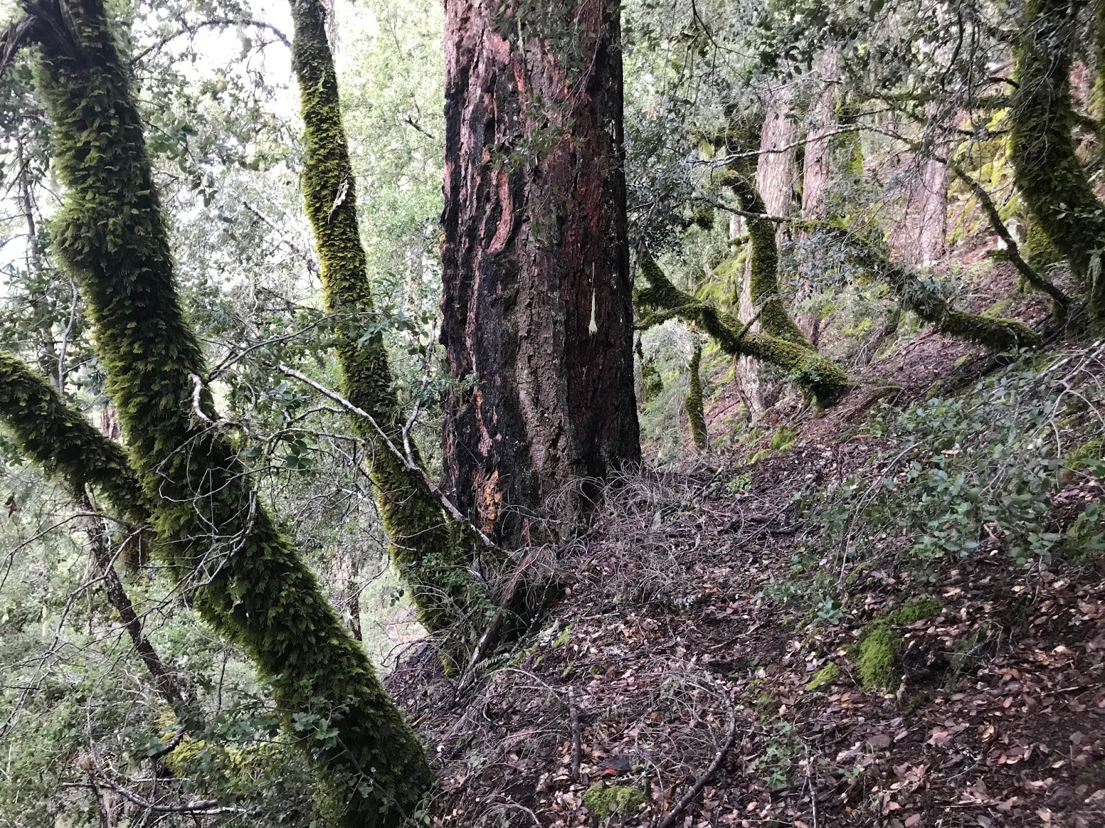
| Oak woodland underburned in the 2018 Klamathon Fire. |
The Rogue Basin Cohesive Forest Restoration Strategy
The funding for the Rogue Basin Strategy came from various project partners, including:- Oregon Department of Forestry (ODF) Federal Forest Health Program
- Jackson and Josephine Counties
- Oregon Watershed Enhancement Board (OWEB) Forest Collaborative Capacity Grant Program
- The Nature Conservancy
- Forest Service
- BLM
ODF is a state agency that serves and loosely regulates logging activities on private land and provides fire suppression services for the BLM. ODF oversees one of the most lenient Forest Practices Act in the country and is well known as an aggressive advocate for the timber industry. Both Jackson and Josephine Counties have similar interests related to federal timber production and the funding of county services. The Forest Service and BLM also have annual timber targets they must meet and strong political pressure to log more timber from public land.
 |
| The mature mixed conifer forest in the upper portion of the photograph was thinned by the BLM in the O'lickety Timber Sale in the Little Applegate Watershed. This timber sale supposedly had fuel reduction and ecological objectives along with timber production. The stand was thinned to roughly 40% canopy cover, slightly lower than the level proposed in portions of the Rogue Basin Strategy. The results of the O'lickety Timber Sale included high levels of windthrow and post-treatment mortality. |
Proposed logging "treatments" would target late successional stands (i.e. old forests) and would be implemented with no diameter or stand age limits. The Rogue Basin Strategy also proposes intensive overstory thinning in forested stands, reducing canopy cover to between 42% and 54% on average.
 |
| Fire-adapted, late successional forest was proposed for logging in the Pickett West Timber Sale in the foothills of the Applegate Valley. We were told that logging this stand would reduce fire risks and fuel loading, while increasing forest health; however, the canopy removal proposed would have done the opposite. |
The Pickett West Timber Sale was highly controversial throughout southern Oregon and was ultimately canceled due to public outrage and impacts to Northern spotted owl and red tree vole habitat. Many local environmentalists are concerned how federal land managers may interpret and implement the Rogue Basin Strategy, especially under the BLM's timber heavy 2016 Resource Management Plan.
The Rogue Basin Strategy Proposes to Increase Logging in Old Forests and Northern Spotted Owl Habitat
 |
| This forest outside Selma, Oregon was proposed for logging in the BLM's Pickett West Timber Sale. The unit was proposed as an "Ecological Restoration" thin and was designed "with the Rogue Basin Cohesive Restoration Strategy... in mind." The proposal would have logged this late-successional stand to 30% canopy cover, converting it from closed-canopy, late successional forest to an "open" forest structure. The unit was canceled in the Pickett West Timber Sale and has recently been included in the Clean Slate Timber Sale as unit 3-11. |
The Rogue Basin Strategy projects 66 million board feet of merchantable timber annually from commercial logging on federal lands. It also encourages logging in closed canopy, older forests (mid and late seral), claiming that the Rogue Basin currently supports an "excess" of these conditions. One of the goals of the strategy is to "balance" successional stages and vegetation mosaics by converting these supposedly "excess" stands of closed canopy, late and mid seral forest into open canopied stands.
This type-conversion, from closed forest to open forest, is a central feature of the Rogue Basin Strategy that will be facilitated by downgrading or removing existing Northern spotted owl habitat. In many stands, reaching the proposed basal area and relative density recommendations, while achieving conversion from closed to open stand conditions, will require the removal of many large, fire-resistant trees. This approach encourages homogenization on the stand and landscape level, creates uncharacteristic structural conditions, and increases fuel loading. The proposed treatments could significantly impact imperiled Northern spotted owl habitats and biodiversity associated with old, complex canopy structures.
In fact, according to the Rogue Basin Strategy, closed canopy, late seral forest types are prioritized for treatment with a "priority multiplier." This means closed canopy, late successional forests are prioritized for treatment two times higher than young, heavily altered plantation stands. Instead of focusing restoration efforts on those portions of the landscape with the most obvious forest degradation and unnatural fuel loads (e.g. plantations), the Rogue Basin Strategy is emphasizing treatment in fire-resistant, late successional stands where commercial timber is more readily available.
 |
| This beautiful mixed conifer forest was proposed for logging in the Pickett West Timber Sale. The stand contains significant diversity, heterogeneity and late successional conditions. The unit is now proposed in the Clean Slate Timber Sale as unit 9-5. Many local ecologists and environmental activists are particularly concerned how the Medford District BLM will interpret the Rogue Basin Strategy. The current BLM Resource Management Plan proposes volume-driven commercial logging and the agency will happily convert closed-canopy, late successional forest into open structured forest, as was proposed in the Pickett West, Clean Slate and Griffin Halfmoon Timber Sales. |
Instead of enhancing Northern spotted owl habitat, the proposal would either downgrade or remove thousands of acres of suitable habitat and fragment important connectivity corridors. Proposed treatments would also remove many important habitat elements such as large trees over 20" in diameter, interlocking canopy structure, understory shrub cover, snag habitat and downed wood.
The Rogue Basin Strategy Proposes Logging in Specially Designated Conservation Areas
Unfortunately, very few areas have been excluded from "treatment" in the Rogue Basin Strategy. In fact, the strategy is proposing commercial logging in Inventoried Roadless Areas (IRA), Botanical Areas, Research Natural Areas, Late Successional Reserves, National Monuments, and other management designations that currently restrict or limit commercial logging.
The strategy clearly states, "Late Successional Reserves, Roadless Areas, Research Natural Areas, and National Monuments were included as candidates for mechanical treatment" (Rogue Basin Strategy. P. 35). Logging these habitats will compromise decades of conservation efforts and degrade their ecological and social values.
 |
| This "Factsheet" identifies proposed "treatment areas" in the Upper Applegate Watershed and numerous Inventoried Roadless Areas. The orange polygons represent treatment areas proposed in the Rogue Basin Strategy. The areas outlined in red are Inventoried Roadless Areas where large treatment areas are proposed. The blue line depicts the boundaries of the Red Buttes Wilderness. For reference, Grayback Mountain is at the top near the number 15 and the yellow square to the left is the boundary of the Oregon Caves National Monument. The Applegate Reservoir is the body of water to the right of the Collings-Kinney Roadless Area. |
Although the strategy assures us that, "the ecological benefits of restoration thinning are the sole justification for mechanical treatments" (Rogue Basin Strategy P. 35), these justifications do not erase the real impacts associated with commercial logging and road reconstruction.
For example, the Rogue Basin Strategy identifies the Chetco Divide/Doe Gap Trail in the South Kalmiopsis Roadless Area as a road to access treatment areas along the wild and spectacular ridge system dividing Rough and Ready Creek from Baldface Creek. The same is true for portions of the McGrew Trail and Biscuit Hill Trail, and old roads in the Rough and Ready Creek and West Fork Illinois River drainages. Obviously, reconstructing long-abandoned mining roads throughout the South Kalmiopsis Roadless Area would significantly alter its wilderness and roadless qualities. Similar treatment areas are proposed in numerous of the roadless areas bordering the Kalmiopsis Wilderness.
 |
| This "factsheet" identifies treatment areas proposed in the Rogue Basin Strategy. The orange polygons show proposed "treatment" areas. The red line depicts the boundaries of the South Kalmiopsis and Packsaddle Inventoried Roadless Areas. The treatment areas in the South Kalmiopsis are located adjacent to long-abandoned mining roads, many of which have been turned into trails. This includes the McGrew Trail, the Biscuit Hill Trail, the Doe Gap Trail, and numerous old decommissioned roads in the Rough and Ready Creek and West Fork Illinois River watersheds. Many of these areas are located on ultramafic soil types and are not in need of "restoration" treatments. |
 | |
| The 2017 Burnt Peak Fire in the Collings-Kinney Roadless Area. |
The Rogue Basin Strategy would impact nearly every wildland and conservation area in southern Oregon, except designated wilderness areas. The environmental community has fought hard for these important designations, and for good reason. These wildlands are the backbone of our regional conservation network, sustaining our regional biodiversity and habitat connectivity throughout southern Oregon. We need areas on the landscape that are not open to industrial forestry in order to maintain the integrity of wildlands for future generations.
 |
| This "factsheet" identifies treatment areas on the Illinois River near $8 Mountain, including large swaths of Inventoried Roadless Area (outlined in red). The area is a unique serpentine habitat with an active fire regime and little need for "restoration" treatments. The stand development patterns and fire regime of this unusual serpentine region is little understood and no credible "restoration" treatments have been implemented in low-elevation serpentine savannas. |
The Connection Between Logging and Climate Change
Recent research conducted by Oregon State University demonstrates that Oregon's forestland, particularly federal forest land, represent significant carbon sinks that should be protected. The report also demonstrates that wildfire related emissions are relatively minimal. According to this new study, the wood products industry is creating 35% of the total emissions in the state of Oregon, while wildfire is contributing a minimal 4%.
Timber production strategies such as clearcut logging and commercial thinning contribute significantly to our statewide carbon emissions and undermine our ability to reduce emissions overall. The OSU report recommends a 50% reduction in timber harvest on federal lands, while the Rogue Basin Strategy would increase harvest levels in terms of both acres treated and volume produced.
The Assumptions and Scientific Basis of the Rogue Basin Strategy
 |
| A clear mixed severity fire mosaic with significant closed canopy forest at the headwaters of the Middle Fork of the Applegate River (left) and Carberry Creek (right) in 1933. The high-severity fire patch on the southern flank of Arnold Mountain burned through a swath of closed canopy forest which dominates the headwaters of both the Middle Fork and Carberry Creek. North-facing slopes, canyon bottoms and even south-facing slopes are colonized by mostly closed forest with rocky and brushy openings from previous fires. |
The Rogue Basin Strategy also includes numerous false assumptions regarding historic landscape conditions and fire regimes, as well as unfounded assumptions about the severity of contemporary wildland fires. For instance, the strategy assumes that stand conditions throughout the Rogue Basin were historically open-canopied due to frequent fire and consistent low-severity fire effects. These assumptions contradict numerous natural historic vegetation studies conducted in the Rogue Basin that document a propensity towards closed vegetation types at all elevations (Leigberg, 1900, Dipaolo and Hosten 2015, Duren et al. 2012, Hickman and Christy 2009, Hickman and Christy 2011). Open stands and open habitats, although present, were the exception and not the rule, even in valley bottom sites that likely experienced the most frequent indigenous burning practices.
The Mixed-Severity Fire Regime
 |
| Mixed-severity fire effects in the 2018 Hendrix Fire in the Little Applegate Watershed. The snag forest in the foreground burned at high severity in the 2002 Quartz Fire and reburned in the Hendrix Fire. Sevenmile Ridge at the center of the photo burned in a low to moderate severity pattern creating heterogeneity, diversity and more fire-adapted forest communities. |
 |
| A view across the Siskiyou Mountains from Anderson Butte looking towards Bald Mountain and Wagner Butte. Take note of the mixed-severity fire mosaic, with patches of closed forest and open areas consisting of poor rocky soils and/or areas burned in high intensity fires. |
The faulty premise that extremely frequent, low-severity fire was the dominant fire regime throughout the southern Oregon Cascade and Siskiyou Mountains leads to the identification of an inaccurate reference condition, with an overemphasis on open structured forest and vegetation as the impetus for widespread thinning. This in turn leads to an assumption that contemporary wildfires are burning more severely than under historic conditions and that "untreated" stands are more likely to burn at high severity, despite a lack of corroborating evidence. This assumption is false for multiple reasons, including the vegetation dynamics across the region and the actual effects of contemporary wildfires.
 |
| The Cascade Mountains and the Upper Rogue River watershed from Hershberger Lookout were colonized by vast swaths of closed canopy forest in 1933. |
The mixed-severity fire regime, with its variable fire effects and return intervals, creates vastly different plant communities than a more frequent fire return interval would create. Frequent low-severity fire creates very open canopy conditions and favors early successional species such as pine, hardwoods, and herbaceous plant communities. In contrast, the mixed-severity fire regime in the Klamath-Siskiyou Mountains creates more abundant closed canopy habitat types, mixed with more open stands and patches of complex, early seral habitat. This pattern is evident throughout our region, in historical photographs, early landscape descriptions and in currently fire-adapted habitats.
The Actual Effects of Contemporary Wildfires
 |
| A diverse, ecologically beneficial and restorative mixed-severity fire mosaic in the 2017 Miller Complex Fire in the Middle Fork of the Applegate. |
Contemporary wildfires, although less frequent or widespread then historic fires, continue to operate in a similar manner and are creating similar patterns of fire severity. Many of the habitats affected by recent wildfire are on a trajectory of fire resilience due to an increasingly frequent fire return interval. The fire mosaic has been diverse, productive and characteristic for the region.
The recent wildfires in our region have provided ecological benefits, restoring fire process, fire-adapted plant communities and wildfire mosaics. They also provide highly effective fuel reduction on the landscape scale. Actively managing wildfire for resource benefit, although politically controversial, is possible even in the suppression context. Recent wildfires have had restorative benefits and in many cases have the potential to "treat" more acres in a more natural and diverse mosaic than any other form of "active management."
Predicted On-the-Ground Impacts of the Rogue Basin Strategy
 |
| A commercial logging unit in the O'Lickety Timber Sale in the Little Applegate Watershed on BLM land. The project proposed to create more open structure forest by heavily logging mid-successional forest of Douglas fir. The result was simplified forest structure and a loss of Northern spotted owl habitat. |
For example, the intensity of logging proposed, the heavy removal of overstory canopy, and the prioritization of treatments in late successional, closed canopy forest will create extensive habitat fragmentation, disrupt connectivity between late successional habitats and degrade late successional habitat conditions utilized by the Northern spotted owl.
Many of the same mid to late successional forests targeted for logging are currently highly fire resistant and the extensive canopy removal required to create "open" forest will increase fire risks by regenerating dense understory vegetation. Heavy thinning will also desiccate forest stands by increasing solar radiation, ambient air temperatures and access to drying winds.
 |
| Heavy understory regeneration and fuel loading following a commercial thinning operation on BLM land in the Middle Applegate Watershed. |
Trees will be yarded using tractors, cable systems and helicopters. These yarding impacts are documented to include soil compaction, increased surface erosion rates, sedimentation into nearby streams, damage to residual "leave" trees and the spread of noxious weeds. The impacts are often unavoidable to one extent or another in any commercial logging operation and they will be compounded as the number of acres treated this way increases.
 |
| A linear, cable yarding corridor in the BLM's Cheney Slate Timber Sale in the foothills of the Applegate Valley. |
Although no new roads are proposed in the Rogue Basin Strategy, it is highly likely that the Forest Service and BLM will propose new roads to access timber in many of the proposed helicopter yarding areas. This may require the removal of larger trees to pay for yarding costs and road construction, as often happens in federal timber sales.
Many roads proposed to access treatment areas in the Rogue Basin Strategy have long been abandoned, would require significant road reconstruction, and should be closed to reduce environmental impacts. Some of these roads are poorly constructed and are failing, while others are located in riparian areas. These roads create disproportionate impacts to nearby rivers and streams, and instead of decommissioning them to achieve restoration goals, the Rogue Basin Strategy proposes the reconstruction of many roads, including those extending into Inventoried Roadless Areas and other conservation areas.
Capitalizing on current political dynamics, as well as the public's deep-seated misunderstanding of fire and hatred for smoke, this brand of forestry is being propelled by fear, politics and false promises that smoke and wildfires will be drastically reduced. Utilizing the disaster capitalism model, the Rogue Basin Strategy is gaining steam within a climate of anger and a false presumption of ecological catastrophe. This sense of urgency is propelling the proposal forward without a realistic analysis of its science, assumptions, or ecological impacts.
 |
| The vast serpentine habitats of the Kalmiopsis region are best managed with wildfire. Many of the watersheds are simply too remote to conduct forest management activities and wildfire provides the most effective, dynamic form of fuel reduction. |
The best way to restore an active fire regime is to manage wildland fire in the backcountry, while focusing our manual restoration activities in plantation stands, at strategic locations, and around homes and communities. By preparing local communities with defensible space treatments, safe ingress and egress routes, strategic firebreaks, and prescribed fire treatments, we can more effectively utilize unplanned ignitions in the backcountry for resource benefit, while protecting communities from wildfire impacts.
 |
| Fuel reduction thinning and prescribed fire is appropriate next to homes and in strategic locations near communities. It can also be useful in plantations and in heavily altered landscapes, but is unnecessary in the backcountry. |
Wildfire is a reality on this landscape, with a long history of beneficial ecological effects and social impacts. We cannot remove wildfire or smoke from this landscape, nor can we replace their important ecological functions with manual treatments. Wildfire and smoke are a natural and inevitable part of our Mediterranean climate and forest ecosystems. As someone who has had wildfire (the 2017 Miller Complex) surround my own rural property, I believe a little humility, tolerance and a dose of reality may go a long way in providing us with solutions. Increased federal land logging in our last old forests, roadless areas, botanical areas and other important conservation areas is not the answer. We must ask ourselves the question: Do we want forest restoration or forest industrialization?
Download the Rogue Basin Cohesive Forest Restoration Strategy here.
This comment has been removed by a blog administrator.
ReplyDeleteThis comment has been removed by a blog administrator.
ReplyDeleteThis comment has been removed by a blog administrator.
ReplyDeleteThis comment has been removed by a blog administrator.
ReplyDelete