Tuesday, November 27, 2018

The Klondike Fire Along the Illinois River Trail


A view from the Illinois River Trail to Pine Flat after the Klondike Fire.

The Klondike Fire Along the Illinois River Trail
 

The Klondike Fire burned along the majority of the Illinois River Trail this summer, deep in the heart of the Kalmiopsis Wilderness. The fire burned in a natural mixed-severity mosaic through the 2002 Biscuit Fire footprint. The Klondike Fire burned in a diversity of habitats, including closed-canopy mixed conifer forests, serpentine woodlands, chaparral and forests of sun-bleached snags. The fire reduced fuel, recycled nutrition and continued shaping the fire- adapted forests of this wild region.  

As part of Klamath Forest Alliance's Klamath-Siskiyou Fire Reports, we have been out on the ground exploring the Klondike Fire, its fire effects, fire suppression impacts, and trail conditions. Below is a photo essay of the Klondike Fire along the Illinois River Trail. All photos were taken recently from the Illinois River Trail, in mid-November 2018.

The Illinois River Trail can be accessed during the winter months as long as snow levels remain high; however, the eastern access at Oak Flat immediately crosses Briggs Creek on a large bridge, and the wood on the bridge burned in the fire, making the bridge crossing unsafe. We crossed Briggs Creek by fording the stream, but now that rain has returned and water levels may be up, that crossing may be unsafe as well. The western access from Oak Flat near Agness should be accessible through the winter months, but winter weather can impact trail conditions, so use caution. 

Looking up the Illinois River towards the confluence of Briggs Creek.
The rugged Illinois River canyon in the heart of the Kalmiopsis Wilderness downstream from Nome Creek.


Old growth forests burned at low to moderate severity in the Clear Creek watershed.
Native plants such as the rare western sophora (Sophora leachiana) sprouted back quickly after the Klondike Fire. Species like western sophora will expand their populations due to the effects of the Biscuit and Klondike Fires. These native plant populations have been "restored" through the effects of high-severity fire.
The incredible clear, blue waters of the Illinois River wind through the Kalmiopsis Wilderness and the Klondike Fire.

A sharp bend in the Illinois River at the confluence of Clear Creek and the Shorty Noble site. Notice the low to moderate severity fire effects in the mixed conifer forests of the Illinois River canyon.
A beautiful bend on the Illinois River near Nome Creek.

Umbrella plant (Darmera peltata) along Briggs Creek.

The Illinois River and Silver Peak above the confluence of Indigo Creek. Notice the low severity fire effects in the lush conifer forests below Silver Peak. The fire burned low and cool beneath towering forests of Douglas fir, sugar pine, tanoak and madrone.The snags in the foreground are from the 2002 Biscuit Fire.
The Indigo Creek canyon along the Illinois River Trail. The Klondike Fire burned in the immediate vicinity, but the snags in the background are from the 2002 Biscuit Fire. The Klondike Fire still refused to burn on the serpentine slopes above.

Understory fire burned beneath the beautiful old-growth forests surrounding Fantz Meadow.

Fantz Meadow following the Klondike Fire.

The small historic structure and rusted farm equipment at Fantz Meadow made it through the Klondike Fire. The fire burned at mostly low severity surrounding Fantz Meadow.

Low severity fire burned the under brush around Fantz Meadow while maintaining the old-growth canopy.
A view up Indigo Creek showing mixed severity fire effects.

The incredible Illinois River canyon upstream of Indigo Creek, following the Klondike Fire.

The wild, rugged Illinois River canyon.

KFA is in the midst of field work, document review, and analysis of this season's wildfires, including the Klondike Fire. We are in the process of preparing fire reports throughout the region. Please consider making a donation and supporting our work. 

For more information: klamathsiskiyoufirereports.org


Sunday, November 18, 2018

Klamath Forest Alliance-Siskiyou Field Office: A Year of Activism in the Siskiyou Mountains

A rainbow below the Siskiyou Crest in the Elliott Creek canyon.
2018 has been a busy year for Klamath Forest Alliance (KFA). We started the year by officially opening our Siskiyou Field Office, based in the Applegate Valley, at the heart of the Siskiyou Mountains. 

KFA's Siskiyou Field Office roams the region monitoring federal land management projects on the Rogue River-Siskiyou National Forest, the Klamath National Forest and the Medford District BLM. Each year we hike hundreds of miles in steep, rugged terrain monitoring timber sales, OHV trails, grazing allotments and fire suppression impacts in the rain, snow, smoke and heat. We work from southern Oregon's Wild Rivers Coast and across the Siskiyou Crest to the Cascade-Siskiyou National Monument.

KFA also spends countless hours writing public comments, administrative objections, appeals and monitoring reports informed by our on-the-ground monitoring efforts. We attend meetings, field trips, and workshops with local land management agencies, advocating for conservation and the protection of wildland habitats. We educate, organize and empower local communities to become advocates for their watersheds and join regional conservation partners on important campaigns across the region.

Gentiana calycosa (Traveler's gentian) on the Siskiyou Crest.
Our goal is to protect, defend and restore wild places, ancient forests, clear flowing streams, and biodiversity. KFA is a place-based, on-the-ground environmental organization utilizing grassroots community activism, science, passionate advocacy, environmental education, and litigation to achieve tangible conservation victories. 

Please consider making a year-end donation to KFA and support conservation throughout the Siskiyou Mountains.

In 2018, KFA worked on the following conservation campaigns:

Timber Sale Monitoring

KFA's Siskiyou Field Office works across the region monitoring federal timber projects on both BLM and Forest Service lands.

Clean Slate Timber Sale
Ancient forests like this one are targeted for logging in the Clean Slate Timber Sale outside Selma, Oregon.
KFA and regional conservation partners spent much of 2017 opposing the Pickett West Timber Sale, a massive logging project proposed by the Medford District BLM on the Wild and Scenic Rogue River, the mountains above Selma and in the Applegate Valley. Due in part to our efforts, thousands of acres of forest, including intact old-growth stands, were withdrawn from the Pickett West Timber Sale. Despite significant public opposition, the BLM reoffered portions of the Pickett West Timber Sale in the Deer Creek watershed as the Clean Slate Timber Sale. 
KFA has been out in the field monitoring the proposed timber sale units and documenting potential environmental impacts. We found numerous old-growth units proposed for logging and submitted both extensive public comments and administrative objections to the Clean Slate Timber Sale. 
Unfortunately, the Medford District BLM approved the Clean Slate Timber Sale, yet it has not sold in timber auction and remains unlogged. It is clear that BLM will be reoffering the sale in the next timber sale auction and KFA will be opposing this project every step of the way.

Savage Murph Timber Sale
This beautiful old forest above North Applegate was originally proposed for logging in the Savage Murph Timber Sale, but was withdrawn due to pressure from KFA and other conservation allies.

The Savage Murph Timber Sale was the Applegate Valley portion of the Pickett West Timber Sale. Although public outrage and impacts to both habitat and prey sources for the Northern spotted owl forced the BLM to cancel large portions of the Pickett West Timber Sale. They did not initially cancel the Applegate Valley portions. This became the Savage Murph Timber Sale. 

Located in the mountains above North Applegate, Murphy and Wilderville, Oregon, the project sprawled across vast acreages. Originally, 2,229 acres were proposed for commercial logging , including numerous old-growth units and the construction of significant new roads. Much to the displeasure of the surrounding community, the BLM was also proposing to log within the proposed Applegate Ridge Trail corridor. 

KFA joined forces with local conservation partners at the Applegate Neighborhood Network and successfully encouraged BLM to withdraw all the old-growth and old forest logging units, as well as new road construction. We also protected large portions of the proposed Applegate Ridge Trail corridor, a non-motorized trail proposed by the Applegate Trails Association. Currently, the BLM has reduced the acres proposed for logging by 86%, to 192 acres. The BLM has tried once to sell the timber sale at public auction and it received no bidders. To date, not a single acre has been logged in the Savage Murph Timber Sale.

Upper Briggs Timber Sale
Ancient forest on the Onion Way Trail was proposed for logging in the Upper Briggs Timber Sale. The project was proposed to "reduce the risk of catastrophic fire" and ironically burned at largely low severity in this summer's Taylor Fire. 


The Upper Briggs Timber Sale has been proposed by the Rogue River-Siskiyou National Forest in the Briggs Creek watershed, an important tributary of the Illinois River. The proposal calls for logging in old-growth forests, adjacent to important meadow systems, on numerous recreational trails, near the Sam Brown Campground and the Horse Meadow Wildlife Area. 

KFA conducted extensive field monitoring on this timber sale. We organized local opposition in the conservation community and submitted detailed public comments on the Upper Briggs Timber Sale. Before the Rogue River-Siskiyou National Forest could make a decision, the Taylor Fire burned through the area at mostly low severity. KFA has filed documents with the Rogue River-Siskiyou National Forest to withdraw the timber sale due to changed environmental circumstances associated with the fire and will be tracking future developments in the Briggs Creek watershed.

Post-Fire Logging Campaigns
KFA works throughout the region fighting environmentally damaging post-fire, clearcut logging proposals on federal land. 

Chetco Bar Fire Salvage
The incredible Chetco River watershed flows out of the Kalmiopsis Wilderness and into the Brookings Harbor. The Forest Service approved over 9,000 acres of clearcut, post-fire logging in the lower Chetco River watershed.

Following the 2017 Chetco Bar Fire, the Rogue River Siskiyou National Forest proposed a massive post-fire, clearcut logging proposal in the Chetco River Watershed. The Chetco River is one of the most intact watersheds in the West and large portions of the watershed are protected in the Kalmiopsis Wilderness Area. The river supports both exceptional water quality and an incredible run of wild steelhead and salmon. 

KFA conducted extensive field monitoring of proposed timber sale units, demonstrating that significant unroaded habitats and fire-effected old-growth forest were proposed for clearcut post-fire logging in the Chetco Bar Fire Salvage Project. KFA submitted detailed public comments and worked to alter or cancel this damaging post-fire logging project.

Unfortunately, in his first decision as Rogue River-Siskiyou National Forest Supervisor, Merv George Jr. approved post-fire clearcut logging throughout the lower Chetco River watershed on over 9,000 acres. KFA will continue monitoring this project to document and demonstrate the environmental impacts associated with post-fire, clearcut logging. 

Seiad Horse Project
KFA in the field, looking across the Seiad Horse Project Area to the Red Buttes Wilderness Area.

Following the 2017 Miller Complex Fire that burned roughly 36,000 acres on the Siskiyou Crest in and around the Red Buttes Wilderness, the Kangaroo Roadless Area and the Condrey Mountain Roadless Area, the Klamath National Forest proposed a large post-fire, clearcut logging project near Cook and Green Pass, the PCT, two Late Successional Reserves and even within the Kangaroo Roadless Area. 

KFA went into action, monitoring proposed timber sale units, documenting the beneficial effects of the Miller Complex Fire and advocating for conservation in the Siskiyou Crest Connectivity Corridor. We submitted extensive public comments and administrative protests opposing the project. 

Unfortunately, the Klamath National Forest approved this devastating post-fire logging proposal, forcing KFA and regional conservation partners, the Environmental Protection and Information Center (EPIC), KFA and KS Wild to file a lawsuit opposing the Seiad Horse Project. Although we have yet to see our day in court, we hope to stop the Seiad Horse Project and protect the connectivity of the Siskiyou Crest. 


Private Land Acquisitions
Black Mountain

The Selberg Institute's Black Mountain Preserve protects the ancient forests of Black Mountain and the connectivity of the Siskiyou Crest.
In 2018, KFA worked with the Selberg Institute to facilitate a conservation buyout of the Black Mountain Parcel. The Black Mountain Parcel is a 240-acre privately owned, old-growth forest surrounded on all sides by the over 20,000 acre Condrey Mountain Roadless Area. The forest is embedded within some of the most intact old-growth forest in the eastern Siskiyou Mountains and the Applegate River watershed.

Historically, owned by the Fruit Growers Supply Company (FGS), a private timber company located in Hilt, California, the Black Mountain Parcel contains incredible old-growth forests, the headwaters of numerous clear-flowing streams, wetlands, glades and beautiful rock outcrops. These forests contain one of the only stands of Pacific silver fir on the Siskiyou Crest and the state of California. 

In 2017, the Miller Complex Fire burned through the area at low severity leaving the vast majority of the old-growth canopy intact. Despite the positive fire effects and unscathed canopy, FGS was threatening to apply for an "emergency fire salvage" permit to clearcut the parcel. The logging was to occur this past summer, but instead KFA and our conservation allies at Applegate Neighborhood Network and Selberg Institute joined forces to secure a conservation buyout of this important and irreplaceable wildland habitat. Our friends at the Selberg Institute are now the proud owners of the Black Mountain Preserve and the parcel has been permanently protected from commercial logging or other development activities. 

Everyone in this region who loves wild places, old-growth forests and the connectivity of the Siskiyou Crest owes the Selberg Institute a debit of gratitude for their efforts to permanently protect the old-growth forests and conservation values of Black Mountain and the Condrey Mountain Roadless Area. Although much of the buyout effort was facilitated by the Selberg Institute, KFA played a vital role in identifying the threat and working to find allies who could secure the protection of Black Mountain. KFA is honored to have participated in this inspirational conservation victory. May Black Mountain forever remain wild!

Collaboration 

Upper Applegate Watershed Restoration Project
The Upper Applegate Valley.
For the last three years, Klamath Forest Alliance and other conservation partners have been working to ensure that the Upper Applegate Watershed Restoration Project lives up to its name and has a truly restorative outcome. 


In many ways we have been largely successful and many of the project proposals will have beneficial results for the environment and for surrounding communities. Klamath Forest Alliance has been supporting proposals to conduct relatively large prescribed burning projects and some fuel reduction thinning projects adjacent to communities in the Upper Applegate Valley. We have also been supporting plantation thinning, some commercial thinning with strong ecological sideboards, unauthorized OHV trail closures, road closures, pollinator/native plant restoration projects and new non-motorized trails. 

The Forest Service also proposed numerous new off-road vehicle trails in the Upper Applegate watershed and in the Boaz Mountain Roadless Area. Local residents, community groups and KFA successfully opposed numerous new motorcycle trails, including those in the Boaz Mountain Roadless Area. Unfortunately, the Forest Service continues to propose a few remaining off-road vehicle trails up Beaver Creek in the Upper Applegate Valley.

KFA will continue to engage in this project and will oppose all new motorized trail development. Motorized trails are simply not "restorative" in nature and have no place in supposed "restoration" projects. An Environmental Assessment for this project is schedule to be released any day now. We will keep you posted. 

Klamath-Siskiyou Fire Reports


The Taylor Fire and Briggs Creek watershed with Chrome Ridge in the distance.
The Klamath-Siskiyou Fire Reports Program is an innovative, one-of-a-kind KFA program documenting the on-the-ground fire effects and the ecological benefits of wildfire in our region. We also document the environmental impacts associated with fire suppression activities. Our Klamath-Siskiyou Fire Reports are utilized to educate the public, oppose post-fire logging proposals, and dispel myths surrounding wildfire in the Klamath-Siskiyou Mountains. The ultimate goal is to reform fire suppression policy and support ecologically appropriate fire management. We know of no other environmental organization with a similar program in the West.

In 2018, KFA published three major fire reports for the 2017 Salmon-August Fire in the Marble Mountains Wilderness, the 2017 Eclipse Fire in the Siskiyou Wilderness and the 2017 Miller Complex Fire on the Siskiyou Crest. 

We are also working on three major fire reports for 2019, exploring the 2018 Klondike and Taylor Fires in the Kalmiopsis region, the 2018 Klamathon Fire in the Soda Mountain Wilderness and Cascade Siskiyou National Monument, and the 2018 Natchez Fire on the Siskiyou Crest in the Siskiyou Wilderness. 

We also use our experience and expertise to advocate in the debate surrounding wildfire and forest management in the Klamath-Siskiyou Mountains. While few other environmental organizations dare to question the current assumptions surrounding wildfire, forest management and historic fire regimes in the Klamath-Siskiyou region, KFA has put ourselves in the center of the controversy, advocating for biodiversity, the reform of fire suppression policy, forest management strategies and the use of managed wildfire. We are actively engaged in education campaigns across the region, promoting a more healthy relationship with fire and more firewise communities.

Check out our new website for more information on the Klamath-Siskiyou Fire Reports.
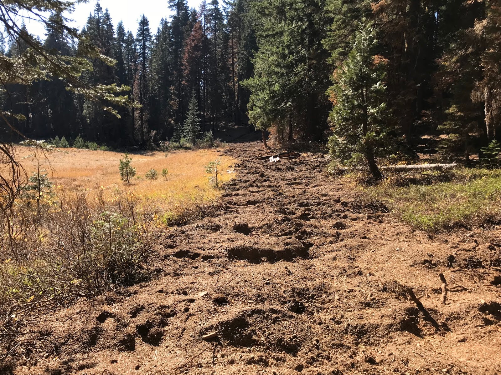

OHV Monitoring
KFA has focused its OHV monitoring on the Botanical Areas of the Siskiyou Crest, where unauthorized motorized use is impacting important botanical values.
KFA continues to monitor and document illegal, unauthorized and/or damaging off-road vehicle activity on federal lands in the Applegate Valley and on the Siskiyou Crest. We submit detailed monitoring reports to the BLM and Forest Service and advocate for closure of damaging off-road vehicle trails. In 2018, we continued focusing on monitoring efforts on designated Botanical Areas on the Siskiyou Crest. 
Looking Forward to 2019 
Founded in 1989, KFA will be celebrating its 30th year advocating for the Klamath-Siskiyou Mountains. For decades we have been protecting wild places, old-growth forests, intact watersheds, connectivity and biodiversity in the Klamath-Siskiyou region. We track federal land management projects on millions of acres and need your support. Please consider making a year-end donation to Klamath Forest Alliance. Help us keep the Klamath-Siskiyou Wild!


Thursday, November 8, 2018

Natchez Fire: Beneficial Fire, Bulldozers and White-Headed Woodpeckers in the Siskiyou Wilderness

A view across the Natchez Fire from Lookout Mountain in the Siskiyou Wilderness.
This summer the Natchez Fire burned in and around the Siskiyou Wilderness Area in the backcountry of the Siskiyou Crest. The fire started on July 15, above Takilma, Oregon at roughly 4,400' in elevation in the Poker Creek Watershed. The fire eventually burned over the ridgeline and into the rugged watersheds in the South Fork of Indian Creek above Happy Camp, California. 


With over 100 fires spread throughout the Rogue River-Siskiyou National Forest in mid-July, the Natchez Fire was not a high priority, and being understaffed, it continued to grow in remote and rugged terrain. The sheer number of fires and the proximity of many wildfires to nearby communities overwhelmed fire suppression crews, forcing them to prioritize. 

Fires like the Natchez Fire, burning far from residential properties or communities, dropped to the bottom of the priority list. This meant that although attempts were made to suppress the Natchez Fire, crews could not successfully minimize the acres burned with an initial attack strategy. The necessary resources were not available and the terrain was simply too dangerous and extreme. Instead, crews pulled back, creating indirect firelines along existing forest roads and on the ridgeline between Little Greyback and Poker Flat, a large meadow system and designated Botanical Area adjacent to the Siskiyou Wilderness Area.
The Natchez Fire burned at mostly low severity in the forests around Poker Flat at the edge of the Siskiyou Wilderness, but did not burn directly into the meadow system itself.

By July 23, the fire was over 2,000 acres and had spotted over existing firelines, becoming established in the headwaters of Indian Creek, high above the Klamath River and Happy Camp, California. On the evening of July 25, the Natchez Fire made a significant uphill run, again spotting over containment lines near Poker Flat. Crews began to scramble, working to keep the fire from burning into the rugged Siskiyou Wilderness Area to the south. 

In response, crews began to bulldoze into the Siskiyou Wilderness on the Poker Flat Trail and on the spine of the Siskiyou Crest. Crews bulldozed at least two miles on the Poker Flat Trail, turning the former wilderness trail, on a long-abandoned mine track, into a dusty, disturbed dozerline. They bulldozed through headwater streams, old-growth forests, serpentine outcrops, high mountain meadows, and beautiful Jeffery pine savanna. Crews also felled large, old trees and snags along the dozerline, creating additional impacts to the region's spectacular wilderness qualities. 

In addition to the bulldozing of the trail and old mine tracks, new dozerline was scrapped across the Siskiyou Crest above the Poker Flat Trail. This egregious bulldozing of an intact wilderness ridgeline will have long-lasting ecological impacts. 
This small meadow in the Siskiyou Wilderness on the Poker Flat Trail was bulldozed by fire suppression crews.

Fire crews also opened old mining tracks that extend deep inside the Siskiyou Wilderness Area in order to facilitate driving into Twin Valley and a freshly constructed helipad on the ridges above Kelly Lake. The long-term damage to native plant communities, clear flowing streams and wilderness values was significant, and to make matters worse, these wilderness dozerlines did not contribute towards the fire's ultimate containment.

On July 27, when the fire activity increased, spot fires became established south of the dozerlines into both the South Fork of Indian Creek and Twin Valley Creek, making the wilderness dozerlines completely obsolete. At this point, crews were left with little option but to abandon the dozerlines punched into the Siskyou Wilderness. 
 
Massive old trees up to 7' diameter were removed along the Poker Flat Trail during fire suppression. This tree was removed on the Siskiyou Wilderness boundary. Fire crews also bulldozed through the headwaters of Sutcliffe Creek's West Branch.


At the same time, dozers began pushing into the roadless headwall of Dunn Creek, attempting to cut off the fire's western flank. The dozerline was built on extremely steep, erosive slopes and was quickly passed up by the Natchez Fire's western movement. 

After doing great damage to the Siskiyou Wilderness by bulldozing open old mine tracks, creating new dozerline on ridges, felling hundreds of snags and blasting apart rock outcrops with "fireline explosives", crews finally began to implement Minimum Impact Suppression Tactics (MIST) developed to maintain wilderness values while suppressing wildland fires. MIST is mandated under the Klamath National Forest Plan in the Siskiyou Wilderness Area, but in this situation, was instead used as a last resort, when more aggressive and impactful suppression tactics failed. 

In the end, crews used natural barriers to slow and contain the fire. In this case, these natural barriers were composed of a series of sharp and relatively barren granitic peaks to the west of the fire, extending from Preston Peak to the Lieutenants, Polar Bear Mountain and along with the open serpentine slopes of Lookout Mountain. Adjacent to these sharp peaks was last year's Eclipse Fire footprint, creating an impermeable firebreak to the south-southwest. Crews worked to steer the fire towards these relatively fire impermeable summits and recent fire footprints, containing the fire by corralling it into the wilderness.
 
The Natchez Fire burned at low- to moderate-severity at the headwaters of the South Fork Indian Creek. The large granitic summits in the background, including Preston Peak, Copper Mountain and El Captain, were used as a "natural barrier" to contain the western flank of the Natchez Fire.


The fire was also backing moderately into the South Fork of Indian Creek in the Cole Creek drainage burning towards a few isolated rural residences. Fire crews successfully defended all threatened structures and for a short time held the fire on the South Fork of Indian Creek. 


Low-severity fire in the South Fork of Indian Creek.
On August 12, the fire spotted across the South Fork of Indian Creek into extremely rugged and relatively inaccessible terrain. With little opportunity for containment, crews fell back to an unused contingency line from last year's Eclipse Fire. 

Starting at the 2017 Eclipse Fire perimeter near the Baldy Mountain Lookout, suppression crews began methodically backburning into the South Fork of Indian Creek, nearly tripling the size of the fire. This created a safe, effective and relatively low-impact fireline and the tactical firing operations created beautiful low to moderate severity fire effects. It also quite effectively protected the community of Happy Camp from the Natchez Fire.  The decision to initiate large-scale burnouts from the Eclipse Fire contingency line was controversial in some local communities, but should be applauded as appropriate, safe and effective fire management.

On September 25, the Natchez Fire worked its way through the rock near Cyclone Gap, burning over the natural barrier used as fireline and into the headwaters of Clear Creek. The fire burned onto Copper Mountain and Preston Peak, reaching into the Raspberry Lake basin as a mixed-severity fire. Over the course of the next few days the fire marched into Clear Creek and onto the face of Rocky Knob. This portion of the fire burned in the headwaters of Clear Creek until extinguished naturally in October.
The Natchez Fire burned as a low-severity underburn around the shores of Kelly Lake.

In all, over 38,000 acres burned in the Natchez Fire. Although fire severity maps have not been released, it is obvious that large swaths of forest burned at low severity. The Natchez Fire was a beautiful natural event with profoundly beneficial effects. Blanketed by dense smoke inversions and blessed with very little wind, the Natchez Fire burned in a mosaic of mostly low to moderate severity, reducing fuels, maintaining old-growth canopies, invigorating plant communities, and reintroducing natural process to the diversified forests of the Siskiyou Crest. 

Low-severity fire in Lower Twin Valley.
Although the myth of ecologically catastrophic fire has consumed our social and political landscape, the physical landscape and wildland habitats of the Siskiyou Mountains have maintained a healthy and productive wildland fire regime, and few, if any, regional wildfires can be credibly characterized as ecologically catastrophic. Instead, most wildland fires in the Siskiyous have been necessary, inevitable and highly beneficial for natural communities. In fact, much of the forested habitat affected by the Natchez Fire burned in the understory, at low to moderate severity. Large portions of the fire burned cool and low, beneath tall, old trees in Twin Valley Creek, Copper Creek, the South Fork of Indian Creek and near Kelly Lake.

In upper Dunn Creek and Poker Creek, the fire burned in a more mixed pattern, including low-, moderate- and high-severity fire. In places, the fire ran uphill, burning vertical swaths of forest at high severity and leaving behind blackened snag forests, filled with a cacophony of hairy and white headed woodpeckers.

The white headed woodpecker is often abundant in fire-killed forest throughout the Siskiyou Crest. Photo: Frank Lospalluto
Although these patches of forests experienced overstory mortality and trees were killed in the fire, a forest bursting with life still remains. For the next number of years this young, naturally regenerating habitat will be flush with diversity as vegetation responds in abundance and snags soften to create cavities and hollows for wildlife. In the post-fire environment pollinators will feast on the nectar and pollen of native flowering plants; elk and deer will graze on the grasses, forbs and regenerating vegetation; black bears will gorge themselves on abundant berries; while owls, small carnivores and raptors will feast on dusky footed woodrats, mice and rodents in the small openings created by high-severity fire.   
The Natchez Fire in Upper Twin Valley and on the face of Polar Bear Mountain above.
Wildfire, although currently demonized by some in our society, has scorched its essential influence across vast landscapes, shaping the structure, composition and diversity of plant communities throughout the Klamath-Siskiyou Mountains.  

The Natchez Fire burned at low severity in the forests around Brad's Lake.
The Siskiyou Wilderness is one of the most intact and important wildland habitats in the entire Klamath-Siskiyou Bioregion and represents all that wilderness has to offer. According to recent research published in the Journal Nature, wilderness is diminishing worldwide at an alarming rate. According to their estimate 77% of the global land base has been altered by development, logging, agriculture, mining and other economic activities.

The Siskiyou Wilderness, like all wilderness, contains relatively intact biological legacies and remote, isolated landscapes that provide habitat for free-roaming wildfire. Although valuable as a human refuge, wilderness is not just a place to renew our souls,  find solitude and connect with nature. Wilderness defines our landscapes, informs our sense of place and provides the natural world an opportunity to demonstrate the efficiency, artistry, and abundance it can maintain. Wilderness represents the uncontrolled spirit of nature and is one of the only places where natural process can sustain biodiversity at evolutionary time scales.

Free-roaming wildfire burning in late October in the Siskiyou Wilderness at the headwaters of Clear Creek, at the end of the Natchez Fire.