Friday, January 29, 2016

Nedsbar Timber Sale: Cinnabar Ridge Units

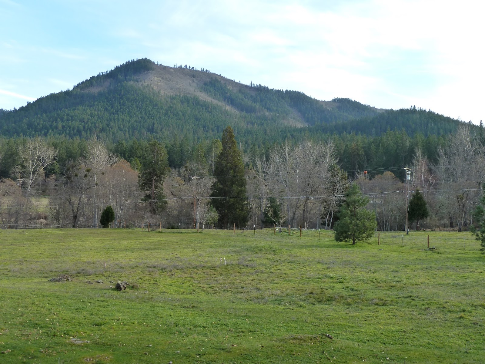
The eastern slope of Cinnabar Ridge in the Little Applegate Valley

The proposed commercial logging units on Cinnabar Ridge are outlined in red. Unit 25-30 is highlighted in this blog. Units 26-30, 23-32, 23-32, and 23-30 are not marked by the BLM. As soon as these units are marked I will be reviewing the mark.

I recently reviewed the tree removal mark for the Nedsbar Timber Sale, including units on Cinnabar Ridge. Cinnabar Ridge is the long ridgeline dividing the Upper Applegate Valley from the Little Applegate Valley. The east slope of the ridgeline drains into Grouse Creek in the Little Applegate Valley, while the west slope drains into Murphy Gulch, Boaz Gulch, Neds Gulch and Mill Gulch in the Upper Applegate Valley. The west face of the slope is arid, rocky and dominated by oak and chaparral plant communities, with large stands of conifer trees on north-facing slopes and isolated conifer "stringers" running down the face of the ridge. The eastern face of Cinnabar Ridge is more forested, but still broken by large, grassy oak woodland and dense stands of chaparral on south-facing slopes.

I visited a number of units on Boaz Gulch Road, Cinnabar Ridge and at the headwaters of Grouse Creek. Below is a report of my findings.


Unit 35-32
Unit 35-32 is moist and productive for the Little Applegate Valley, growing large, old trees. The unit is "leave tree" marked meaning trees marked yellow will be retained. The large tree on the right in the photo is 33" in diameter and marked for removal. 

Unit 35-32 is an anomaly: a moist pocket of forest in the driest watershed west of the Cascade Mountains in Oregon. Located within a rain shadow, the Little Applegate watershed, and particularly the lower half of the watershed, is unusually dry. Yet in a unique area at the headwaters of Grouse Creek, a small pocket of more moist and productive forest can be found. Tucked into a north-facing draw the area grows large, old trees in dense, closed stands. Although dominated by large trees, a layered, multi-age stand is developing. 

Snow bramble (Rubus nivalis) in unit 35-32.
The understory in this stand consists of deep, green moss beds, Cascade Oregon grape, sword fern, and snow bramble (Rubus nivalis). The presence of snow bramble is very surprising at this elevation and geographical location. The plant is found in mostly high elevation sites throughout the Cascade Mountains of Oregon and Washington. It is also found in disjunct populations in the mountains of central Idaho. The Klamath-Siskiyou Mountains are the southern extent of this species' range and it is usually only found at high elevations, often in relatively moist red and white fir forest. Here, in unit 35-32, at roughly 3,000 feet elevation in the Little Applegate Valley, the plant is a rare find and is likely the only population in the Little Applegate watershed. 

In British Columbia snow bramble is considered rare and has been documented to have been impacted by timber sale activities, including soil disturbance and canopy reduction. The B.C. government identifies the plant as a late seral species growing on montane sites and requiring over 75% canopy cover. Yet the BLM is proposing to reduce canopy cover to 40% on this site. The reduction of canopy here will increase exposure to sunlight and drying winds, impacting habitat conditions for this unusual population of snow bramble, possibly ruining the snow bramble's chance to persist at this elevation in the Little Applegate Valley. 

This large, old tree is 42" in diameter and marked for removal. In fact, you can see that the tree was originally marked yellow as a leave tree, but BLM silviculturalists came back through and blacked out the original mark, meaning the tree will now be removed in logging operations. This photo also depicts the understory habitat where the snow bramble is found intermingled with Cascade Oregon grape.

The late-seral conditions in unit 35-32 also sustain roosting and foraging habitat for the northern spotted owl. Logging this stand to 40% canopy cover and the subsequent removal of large, fire-resistant trees will impact these important habitat values. Trees up to 42" in diameter are marked for removal in this unit. Although BLM stand age data identifies the unit as between 100-150 years old, it is very likely that many trees in the unit, and in fact, many trees marked for removal in this unit, are much older. 

Another large tree marked for removal in unit 35-32.

Unit 35-32 is an unusually moist location supporting a unique micro-climate and disjunct plant species requiring closed and moist habitat. Logging this site will impact the specific conditions allowing this plant community to thrive. Proposed logging treatments will also impact the northern spotted owl, remove old, fire-resistant trees and increase fuel hazards due to an aggressive "shrub response" following canopy reduction treatments. The unit should be canceled from the Nedsbar Timber Sale to protect its unique botanical diversity. 


Unit 27-34
Unit 27-34 is beautiful, generally open-spaced, dominated by large trees and relatively moist. Quite a number of large trees grow in the unit, including trees over 5' in diameter in the moist draws. The stand is a poor choice for forest health or restoration thinning treatments (i.e. logging).

Unit 27-34 is located on a north-facing slope above Neds Gulch, at the lower end of Boaz Gulch Road. The unit consists of mid- to late-seral Douglas fir stands, supporting closed canopy conditions. The understory is generally quiet open and mossy with short and scattered shrub-form live oak and hazel. The eastern portion of the unit consists of late seral, fire resilient forest, while the western half has been more impacted by past timber harvesting practices.

The BLM prescription for this unit is Douglas Fir-Selective Thinning, proposed to be cut to 40% canopy cover. The canopy is currently estimated to about 80% canopy coverage, meaning canopy levels will be drastically reduced. This heavy canopy reduction will likely increase fuel hazards on site by encouraging dense shrubby in-growth. 

Currently shrub-form live oak grows in the understory, but its short stature does not present a fuel hazard. Logging that reduces the canopy to 40% will "release" the currently suppressed live oak understory and allow it to grow into tall and dense thickets. Large thickets of shrub-form live oak can create hot and flashy fuel loads, increasing fire risks and fuel laddering into the canopy of trees retained following logging operations.

The unit is "leave tree" marked, meaning the tree at my back, marked yellow, will be retained.  The lower tree — a large, fire-resistant Douglas fir over 30" in diameter — is proposed for removal.


Unit 27-34 currently supports roosting and foraging habitat for the northern spotted owl, the proposed canopy reduction to 40% will impact northern spotted owl habitat values. Much of the stand is identified by the BLM to be between 100 and 200 years old, although numerous large, dominant trees in the stand are likely much older. Massive, old Douglas fir trees are scattered throughout the small draws that dissect the unit. Trees up to 33" in diameter are marked for removal in this stand.  The entire eastern portion of unit 27-34 should be canceled from the Nedsbar Timber Sale. This would include the helicopter yarding portions of the unit. The Nedsbar Community Alternative defers this portion of the unit, while allowing thinning of trees less than 20" in diameter, to 60% canopy cover in the western portion of the stand. 

Unit 25-30
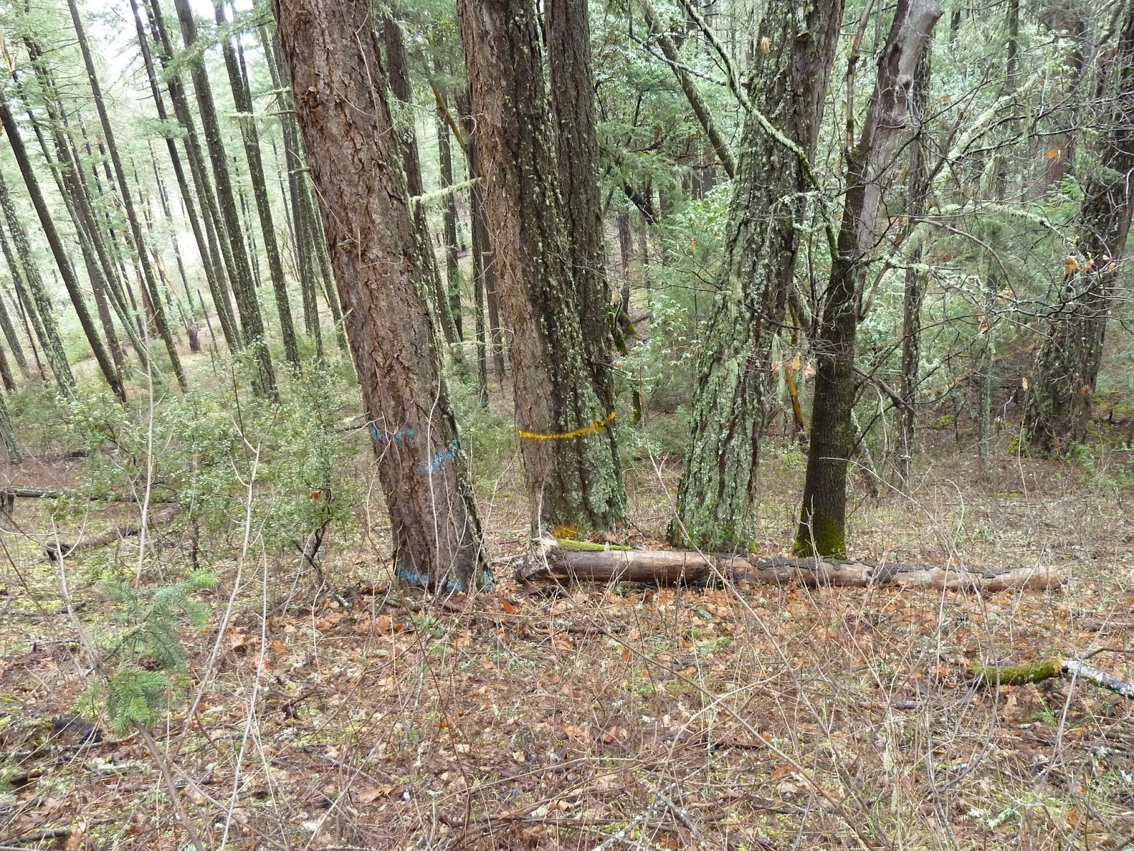
Unit 25-30 is "leave tree" marked, meaning only trees marked yellow will be retained after logging. Both the large fir I am standing next to and the tree below me are unmarked and are proposed for removal. Logging prescriptions call for 40% canopy cover.

Unit 25-30 is a beautiful, late-seral stand of Douglas fir on the east face of Cinnabar Ridge. This unit is located adjacent to a large clear-cut, harvested by the BLM in the Cinnabar West Timber Sale. This timber sale was a galvanizing moment in the development of the conservation movement here in the Applegate Valley. Unfortunately, despite strong community opposition, the sale was cut and roads were built across Cinnabar Ridge in the 1980's. Today, the BLM is coming for what's left. Once again, strong community opposition has developed as the BLM proposes to log off large sections of the Little Applegate Valley.

To the south of unit 25-30 is a large, grassy bald with harsh exposure and shallow soils. Currently, the unit is a refugia habitat, providing connectivity across the landscape for late-seral dependent species. The majority of the stand is closed canopied forest with trees from 2'-4' diameter. According to the BLM the stand is between 100 and 150 years old, yet individual trees in this late-seral stand are likely much older. 

The stand is classified as roosting and foraging habitat for the northern spotted owl. The proposed 40% canopy retention level would downgrade this habitat to the lowest level of dispersal habitat, no longer providing sufficient late-seral characteristics to provide for roosting and foraging needs. It is also important to note that many units — in four consecutive timber sales in the Little Applegate Valley — have been illegally over-cut by the BLM in recent timber sales. In these sales the agency claimed that logging operations would "treat and maintain" spotted owl habitat. This requires the agency to maintain adequate canopy cover to protect current spotted owl habitat values. In Nesting, Roosting and Foraging (NRF) habitat the minimum canopy requirement is 60% and in dispersal habitat the minimum canopy is 40%. The BLM unfortunately has been consistently missing the mark in the Little Applegate Valley, yet they continue to proposed treatments that will downgrade habitat. 

The large trees with prominent white marks are proposed for removal in the Nedsbar Timber Sale. Many trees between 24" and 30" in diameter are proposed for removal in this stand.

Stand conditions include a very open understory with minimal fuel loads and a high, fire-resistant canopy. Thinning this stand to 40% canopy cover will increase fuel hazards by increasing the level of sunlight reaching the forest floor. This will increase conifer reproduction in the understory and develop brushy fuel loads. It will also increase the potential for crown fire by drying out stands and exposing them to high winds during fire events. 

The most significant fuel risk in the area is the the adjacent plantation stand, clear-cut in 1980 and planted in straight, tightly packed rows of ponderosa pine. The old clear-cut was recently thinned by the BLM, using plantation management techniques, where they cut, but did not remove or burn trees targeted for removal — they simply left cut trees on the forest floor. The result was a drastic increase in dry, fine, fire-available fuel, cut up like kindling on the forest floor. The tightly packed trees and homogenous stand conditions are ripe for a high severity fire and the BLM has only made the situation worse. Logging unit 25-30 will compound these fire risks and reduce the stand's resilience to fire. Unit 25-30 should be canceled. 


The marking review will be ongoing; we still have more controversial units to evaluate. The Applegate Neighborhood Network and Klamath Forest Alliance have again joined forces to conduct citizen-based monitoring and conservation advocacy. Please consider supporting this effort with a donation. We depend on community members to defend the wildlands that surround our homes. 


Sunday, January 24, 2016

Southern Oregon rallies in support of the Malheur Wildlife Refuge


Rally in support of public land, social justice, and the Malheur Wildlife Refuge in Ashland, Oregon, on January 23, 2016.

More than seventy people came out on a rainy Saturday afternoon in Ashland, Oregon yesterday to show support for the people of Harney County, Oregon, where an armed occupation of the Malheur National Wildlife Refuge is about to enter its fourth week. The lives of many people in Harney County have been severely disrupted as this armed occupation of public land drags on.

The rally was organized by Oregon Action — their mission: "Led by people of color, immigrants and refugees, rural communities, and people experiencing poverty, we work across Oregon to build a unified intercultural movement for justice." With a strong social justice message, Oregon Action organized the rally with multiple speakers who each touched on the far-reaching impacts the occupation of the Malheur Wildlife Refuge is having on the people of Harney County, as well as the country as a whole.


The rally showed support for the Burns Paiute Tribe and for their ancestral lands that are now the Malheur Wildlife Refuge, occupied by armed militants. Burns Paiute Tribal Chair Charlotte Rodrique has said, “Armed protestors don’t belong here. By their actions, they are endangering one of our sacred sites. This is still our land, no matter who is living on it.”

Burns Paiute Tribal Council member Jarvis Kennedy asked at a press conference earlier this month: “What if it was a bunch of natives that went out there and overtook that? Would they let us come into town and get supplies? They just need to get the hell out of here. We don’t want them here."

According to the Malheur Wildlife Refuge Facebook page, "With the full knowledge and blessing of the Burns Paiute tribe, the Refuge is home to a number of artifacts that have been found on the Refuge during studies carried out to learn more about the history and use of the lands by their ancestors. These artifacts have been curated and stored under lock and key, until the illegal occupants violated the security of the Refuge. 


Moreover, the cultural resources of the Burns Paiute Tribe go beyond archaeological artifacts and objects from the past. Burns Paiute tribal members continue to utilize resources on the lands of what is today the Malheur National Wildlife Refuge as they have for thousands of years to make traditional baskets, cradleboards, tule mats, and even boats."

The themes of social justice were woven into the themes of environmental justice at the rally on Saturday, where people held signs declaring "Grebes not Guns," referring to a bird species that relies on the Malheur Wildlife Refuge for habitat. Another sign read, "Malheur is for the birds," which it is. Malheur Wildlife Refuge was established in 1908 by President Theodore Roosevelt, as the Lake Malheur Bird Reservation.

"The sedges were full of birds, the waters were full of birds: avocets, stilts, willets, killdeers, coots, phalaropes, rails, tule wrens, yellow-headed black birds, black terns, Forster's terns, Caspian terns, pintail, mallard, cinnamon teal, canvasback, redhead and ruddy ducks. Canada geese, night herons, great blue herons, Farallon cormorants, great white pelicans, great glossy ibises, California gulls, eared grebes, Western grebes — clouds of them, acres of them, square miles — one hundred and forty-three square miles of them!"
 - Dallas Lore Sharp  - 1914 - Lake Malheur Bird Reservation

Many people attended the rally simply to show support for public land. The occupation of the Malheur Wildlife Refuge, and the declaration of the armed militants that the Refuge should be given to local ranchers, has alarmed a majority of the country who love public land and don't want to see it privatized. America's public land is what makes this country so spectacular, and it is these public lands that are the cornerstone of healthy, resilient ecosystems and wildlands. KSWild recently led about thirty people on a short walk to Congressman Walden's office in Medford to hand over petitions in support of public land. According to KSWild, "It's not just militants that want to give away public lands. U.S. Congressman Greg Walden recently proposed legislation to give away over a quarter-million acres of National Forests in southern Oregon and northern California."

Longtime social justice and environmental activist,
Dot Fisher-Smith, showing her support for public land.
The Center for Biological Diversity has been on the ground in Burns, OR, directly confronting the armed militants and keeping the public informed about what is happening out there. The Center's director, Kieran Suckling, is providing detailed dispatches from the Refuge on the Center's Facebook page. The Center had this to say about the rallies in support of the Malheur Wildlife Refuge: "These lands belong to all Americans and hundreds of people turned out today to show their love for these wild places and to send a clear message to the people who illegally invaded Malheur that it's time for them to end this fiasco and get off the refuge."

The issue of public lands grazing has been at the forefront of the Malheur occupation, highlighting the need for change and an update of grazing policy to reflect current ecological knowledge and science. Public lands grazing is a major ecological concern in the Klamath-Siskiyou Ecoregion, but thankfully longtime environmental activist, Felice Pace, founded the Campaign to Reform Public Land Grazing in Northern California. Through on-the-ground monitoring and documentation, Felice's group documents the impacts of public lands grazing all over the Klamath-Siskiyou region, including impacts to the Siskiyou Crest. I have helped Felice with some of his field work, and he is doing excellent work. Take a look at his detailed report from the 2015 field monitoring season on the Environmental Protection Information Center (EPIC) website.

My sincerest gratitude goes out to everyone working for a peaceful solution to this egregious armed takeover of the Malheur Wildlife Refuge. I look forward to the day when I can head out there to enjoy the phenomenal population of migratory birds stopping at the Refuge along the Pacific Flyway. The Malheur Wildife Refuge has received more attention than ever, and there is sure to be a huge spike in visitation to this Refuge, contributing to the local economy and supporting Harney County. This will happen as soon as the militants go home!

For more information check out Oregon Public Broadcasting's (OPB) excellent reporting on the issue as well as this great expose of the Hammonds.

Sunday, January 17, 2016

Nedsbar Timber Sale: Boaz Mountain Units

The Boaz Mountain Roadless Area is the scenic backdrop for the farms, homesteads, vineyards, and residences in the Upper Applegate Valley.
The red lines outline the units on the western face of Boaz Mountain. Unit 34-30 will be cut with a group selection prescription, and unit 33-30 with a structural retention regeneration harvest. Both will be cut to 40% canopy cover or lower.

The scenic backdrop for the entire lower end of the Upper Applegate Valley, from Eastside Road and Star Ranger Station to McKee Bridge, is the Boaz Mountain Roadless Area. This area, although little visited or known, is cherished by local residents, recreationalists, and tourists visiting the area's vineyards, hiking trails, picinic areas and campgrounds. Very few people know Boaz Mountain by name, but nearly all Applegate Valley visitors and residents enjoy its wild, beautiful character. 

The Boaz Mountain Roadless Area rises from the Applegate River as a mosaic of old forest, pristine oak woodland, chaparral, and tawny grasslands. An unnamed butte, that some locals call Redberry Butte, rises rocky, oak-studded and magnificent from Eastside Road, above many of our most cherished local swimming holes, and up to a low saddle on the western flank of Boaz Mountain. Extending from Boaz Gulch Road to Beaver Creek Road, the roadless wildland provides not just scenic beauty, but also important wildlife habitat, including nesting areas for the northern spotted owl, habitat for the Pacific fisher, and ideal winter range habitat for the large herds of black-tailed deer in the Upper Applegate Valley.  

The area is an important link in the connectivity corridor extending from the Little Applegate Valley to Upper Applegate Valley, tying low elevation valley bottom and foothill habitats into the high mountains of the Siskiyou Crest. This connectivity corridor has been identified by both the Rogue River-Siskiyou National Forest and the Medford District BLM in the Ecosystem Assessment for the Applegate Adaptive Management Area. Unfortunately, the BLM has proposed two large commercial logging units in the Nedsbar Timber Sale that will impact the Boaz Mountain Roadless Area and the scenic beauty of the Upper Applegate Valley. These units, known as 33-30 and 34-30 of the Nedsbar Timber Sale should be canceled.
 
Unit 33-30 
Open, fire-resilient forest in unit 33-30.

 Old-growth forest in low elevation habitat has become increasingly rare due to industrial logging and development. Very few locations in the Applegate Valley support uncut, old-growth forest directly adjacent to the valley floor. One of these locations is the small rocky butte directly below Boaz Mountain. I call this rocky summit Red Berry Butte due to the presence of a small population of hollyleaf redberry (Rhamnus illicifolia) on it's south and western face. This shrub is common and found throughout the chaparral of California, but it is rare in Oregon, found in only a few locations in the Upper Applegate Valley. This small rocky butte may be the northern extent of this species' range.

On the north slope of Red Berry Butte is a beautiful old-growth stand of Douglas fir and ponderosa pine. The stand is spacious, open, naturally fire-resilient and it provides important late-seral habitat for species such as the Pacific fisher and northern spotted owl. The stand is also proposed for logging in the Nedsbar Timber Sale and has been identified by BLM staff as unit 33-30. The unit is the only "Strucutural Retention Regeneration Harvest" left in the Nedsbar Timber Sale, meaning green tree retention levels will be reduced by logging to 16-25 trees per acre and 30%-40% canopy cover. This treatment is meant to "regenerate" a new cohort of trees, creating a drastic increase in understory ladder fuels. These prescriptions are developed by the agency to "treat" (i.e. log) stands "experiencing deterioration from high stand density levels, insects, disease, or other factors." In this situation, however, the agency has proposed logging in an open, fire-resilient, old-growth stand sustaining low levels of mortality from insects or disease. 

The BLM is proposing to break up this grouping of large, old trees in unit 33-30. The large tree marked yellow in the center would be retained, while the other two trees will be removed. Breaking up this type of late-seral grouping can lead to collateral damage to the leave tree marked for retention. Often the roots of these trees are fused below ground and the branches of the trees interlock, making one composite canopy. Habitat conditions within these groupings are extremely complex, creating high quality, late-seral habitat. The groupings also reflect the historic fire-adapted nature of these forests. The retention of existing large tree groupings contributes to fire resiliency and forest restoration objectives by maintaining historic structural conditions. including groupings of old trees.

Healthy canopy conditions in unit 33-30
The mark in this unit leaves the majority of the big, old trees standing, but some large, old trees are marked for removal. Despite the retention of most of the stand's largest trees, not much forest will remain following the proposed logging treatments. According to information provided by the BLM, only 21 trees will be left per acre in this stand following logging operations. The remaining canopy will be highly fragmented, encouraging the currently open understory to regenerate shrubs, young and highly flammable saplings, and other woody vegetation that will drastically increase fuel loads, fuel laddering, and subsequent fire severity in wildfire events. The proposed logging will also increase the stand's exposure to drying winds and sunlight during fire season, increasing fuel/fire risks to adjacent communities in the most densely populated portion of the Upper Applegate Valley. Other impacts include logging many of the medium-sized, maturing trees in the stand, leaving little green tree recruitment to compensate for mortality in overstory trees and impacting the complex, uneven-aged nature of the stand. 

Unit 33-30 supports old-growth characteristics and many old-growth trees, some over 50" in diameter. Some large snags and a few large downed logs can be found on the forest floor. The removal of large, overstory trees will impede snag and large wood recruitment, impacting habitat values for late-seral species. The majority of the old-growth snags found within the unit will likely be felled by logging crews to facilitate occupational safety standards during helicopter logging operations.

Canopy cover in unit 33-30 is currently 75%-80%. BLM prescriptions propose to reduce canopy cover to 30%-40% while retaining only 21 trees per acre. 

Logging unit 33-30 will impact a rare and unique ancient forest habitat and important wildlife habitat. The proposed logging will increase fuel hazards to adjacent communities, and damage the scenic values of the Upper Applegate Valley, impacting tourism, recreation, property values, and the quality of life for those of us who live here in this beautiful valley.  


Unit 34-30
Unit 34-30 in the Nedsbar Timber Sale includes a series of small clearcuts known as "Group Selection" logging. The trees marked white are proposed for removal. The treatment does not thin stands or reduce density throughout the stand, but instead removes 1/4- to 1/2-acre groves of trees, often with little to no green tree retention. These clearings can be marked on 100' intervals, badly fragmenting the stand and creating openings that are likely to regenerate in dense, highly flammable shrubs, conifer saplings, and stump-sprouting hardwoods.

Unit 34-30 lies on the northwest face of Boaz Mountain, overlooking the entire lower end of the Upper Applegate Valley. The unit lies within the heart of the Boaz Mountain Roadless Area in a mid- to late-seral stand of Douglas fir, madrone, and ponderosa pine. Stand conditions currently consist of relatively closed canopy stands supporting very little understory fuel and only moderate levels of density. At 67 acres the unit is the largest commercial timber sale unit in the Nedsbar Timber Sale.

The BLM has proposed a "Group Selection 40%" logging prescription, meaning they plan to remove groupings of trees of up to 1/2 acre wide, often with little to no green tree retention.  The prescription calls for maintaining at least 40% canopy cover. Openings of up to 1/2 acre can be created on 100' centers, leaving a broken canopy, perforated by small 1/4- to 1/2-acre clearcut patches. According to BLM information, unit 34-30 includes 38 group selection cuts, totaling 10-12 acres of cleared forest. These treatments will greatly increase fuel risks to nearby communities in future years, degrade wildlife habitat for late-seral species, fragment forest habitat, and they will not address forest health needs or concerns. 

The large trees marked with white paint for removal are included in a group selection logging treatment that is removing trees that are likely more than 150 years old. The trees in this photo are nearly 3' in diameter. The area proposed for this group selection cut is relatively open and dominated by large, old trees. 

The groupings of trees proposed for removal include dense groves of young Douglas fir, open, spacious groves of mid-seral Douglas fir, and groupings around old pine trees. Large, fire-resistant trees, from 30" to 36" in diameter are marked for removal, especially in the lower end of the unit. 

The creation of 1/4- to 1/2-acre canopy gaps and the drastic reduction of canopy cover will encourage the regeneration of dense understory fuel in the form of brush, young hardwoods, and highly flammable conifer saplings. The increased understory growth will translate into an increase in fuels in the years following logging treatments. 

A prime example of this shrub response can be found in the forests directly below units 34-30 and 33-30. The forest below was commercially logged in the late 1990s to a similar canopy cover level that the BLM plans for Nedsbar in units 34-30 and 33-30. This adjacent, logged-over forest is now suffering from accelerated overstory mortality and compromised forest health — in other words, the leave trees left behind after logging are dying. 

In this adjacent, previously logged forest, canopy cover reduction has also significantly increased fuel loads by creating logging slash and dense understory growth. This increase in fuels is a direct response to commercial logging treatments conducted nearly twenty years ago. The contrast between these two adjacent stands, where on one side is a forest subjected to logging twenty years ago, and on the other side is an unentered and uncut forest, is night and day, with the logged units unraveling and unhealthy, and the unlogged stands remaining resilient, stable and beautiful. 


Unit 34-30 supports very little understory fuel. The canopy of large, relatively well-spaced trees in substantial portions of the unit have suppressed understory fuels, creating a forest that is resilient to wildfire effects. This picture is taken at the center of a group selection cut and all trees marked with white paint are proposed for removal. 
The condition of forests logged almost twenty years ago by BLM in the Boaz Mountain area. These forest stands are directly adjacent to the photograph above and were logged in the East Side Thin Timber Sale, sold to John West in 1997. The contrast in fuel conditions and overstory mortality levels is pronounced, to say the least. 

Unit 34-30 is identified by BLM as dispersal and roosting/foraging habitat for the northern spotted owl; it is also adjacent to a large stand of old forest that has been identified as nesting habitat for the owl. Unit 34-30, along with the adjacent unit, 33-30, provides important habitat for the northern spotted owl and other sensitive species such as the Pacific fisher. Both species are dependent on lower elevation, old-growth and late-seral forest. The reduction of canopy levels to 40% will provide the absolute minimum canopy cover levels for the northern spotted owl, leaving no flexibility or resiliency of habitat to absorb the inevitable mortality that will follow logging operations, winter storms, drought, wildfire, etc. 

Unit 34-30 should be canceled to protect the values of the Boaz Mountain Roadless Area, it's wildlife habitat, intact forests and scenic vistas.

More work ahead on the Nedsbar Timber Sale

Recently, a group of residents from the Applegate Neighborhood Network (ANN), Klamath Forest Alliance (KFA), and the Nedsbar Community Alternative Working Group, met with the BLM to discuss the Nedsbar Timber Sale. In this meeting the BLM announced that they will not consider dropping any of the controversial timber sale units from Nedsbar Alternative 4, currently identified as the "Proposed Action." The BLM has thrown up significant barriers to effective collaboration by refusing to address the needs of our forests, wildlands, and the surrounding community. Local volunteers have poured over 1500 hours into this collaboration with the BLM in an attempt to promote a more sustainable and environmentally responsible alternative to the Nedsbar Timber Sale. We have also worked to cancel these controversial timber sale units through dialogue, science and collaboration. 

Unfortunately, our work is not done. The BLM apparently still intends to propose largely the same irresponsible timber sale, with the same unacceptable network of new roads, old-growth and late-seral logging units, impacts to northern spotted owl habitat. roadless wildlands and proposed Back Country Primitive Areas. 

Our wildlands, our habitat, our valley, our watershed, and the scenic backdrop for many rural residential properties is under threat. We have more marked units to review, more communities to organize, more public hikes to lead, BLM field trips, meetings, comment periods, and if necessary appeals, and litigation ahead. Please support our work. Consider making a donation to Klamath Forest Alliance, join us at BLM field trips and meetings as well as in our community monitoring efforts. We need your help.
Stop Nedsbar!

Saturday, January 9, 2016

Nedsbar Timber Sale Update: Owl Gulch Units

A "group selection" cut in unit 25-23. The trees marked white are proposed for removal. Group selection prescriptions call for clearing nearly all trees in a 1/4-acre area. No thinning will take place between each group selection cut; however, they can take place on 100' centers throughout the unit, creating miniature clear-cuts in up to 20% of the stand.

Since the spring of 2015, the Medford District BLM has been marking trees for removal in the Nedsbar Timber Sale, a controversial timber sale in the Applegate Valley. The Siskiyou Crest Blog and Klamath Forest Alliance have begun reviewing the tree removal mark in Nedsbar Timber Sale units. We have been focusing our energy on the controversial timber sale units in unroaded wildlands, old-growth or late-seral forest, northern spotted owl habitat, and in stands proposed for cancellation in the Nedsbar Community Alternative. Recently we hiked into units 25-23 and 25-21 in the vicinity of Owl Gulch and Trillium Mountain.  The area is at the heart of the proposed Dakubetede Primitive Back-Country Area and the Trillium Mountain Roadless Area. The BLM used white paint to mark the trees for removal in these units.

Unit 25-23

Unit 25-23 is open, spacious and supports little to no understory fuel. Located within the Trillium Mountain Roadless Area, this unit should be dropped from the Nedsbar Timber Sale. The yellow "T" in the photograph denotes trees marked for removal by the BLM.

Unit 25-23 is located on a low ridge on the eastern flank of Owl Gulch. Lower Owl Gulch is located within the Trillium Mountain Roadless Area in the scenic Little Applegate Canyon. A small section of new road and two new helicopter landing pads are proposed to facilitate logging this beautiful, fire resilient, old stand. 

The unit itself is an isolated conifer habitat, surrounded by oak woodland and chaparral on two sides. Dropping from the ridgeline to the moist canyon of Owl Gulch, this stand is open and spacious with little to no understory fuel. The forest supports late-seral habitat conditions, including large, old-growth trees. According to BLM stand age data the unit is between 100 and 150 years old, although scattered, dominant trees are likely even older. Although healthy, open, and maturing, this stand supports many old-growth characteristics, but is currently lacking in large old snags and large downed logs. Both of these attributes will be negatively effected by the proposed logging by removing large trees that could become future snags and downed woody material.

This unit is identified by the BLM as a "Group Selection 60%" logging prescription, meaning groupings of trees will be removed while maintaining at least 60% canopy cover. According to BLM records this unit is six acres, and three group selection cuts, of roughly a 1/4-acre, are marked in the unit. Douglas fir trees up to 30" in diameter are marked for removal. It appears that canopy cover requirements will not be met in this unit due to the large, dominant, old trees marked for removal. In many cases, it appears large old fir, with big dominant crowns, are being marked to "release" much smaller ponderosa pine trees. These ponderosa pine are often low vigor and support poor height to crown ratios — meaning they are highly susceptible to windthrow and blowdown due to heavy snow or winds. 

Another group selection cut in unit 25-23. The yellow "T" in the photograph below denotes trees marked for removal by the BLM. The largest douglas fir trees targeted for removal in this photograph are 30" in diameter.

Currently open and spacious, this stand represents a portion of the landscape that is naturally fire resilient and healthy. By removing large, fire resistant trees and heavily opening the stand's canopy, fuel loads will increase from "shrub response" as flammable young saplings and woody shrubs fill in canopy gaps with dense, young growth. The problem is evident throughout the Applegate Valley in units heavily thinned by the BLM. Opening the canopy will also expose the stand to increased solar radiation and wind, drying forest soils and fuels earlier in the fire season. In summer fire events, this increased exposure to sun and winds, coupled with shrubby in-growth from excessive canopy reduction, can fan the flames of wildfire, creating more severe fire effects than in more closed canopy stands. Current stand conditions in unit 25-23 have suppressed understory fuels and shrubby understory growth, creating fuel loads that tend to perpetuate low to moderate severity fire effects. 


Measuring a large, fire resilient tree marked for removal in unit 25-23.
This stand is identified by the BLM as roosting and foraging habitat for the northern spotted owl. Being a narrow band of conifer forest surrounded by oak woodland on two sides, the area is important for connectivity and dispersal, providing a habitat linkage for species associated with old, complex forest. Connected to the moist forests in the bottom of Owl Gulch and the late seral forests in the Little Applegate Canyon, the area represents high quality northern spotted owl habitat in a geographic location where old forest values are likely to persist. Unit 25-23 should be canceled to protect unroaded wildlands, wildlife habitat, late-seral forest, and the region's scenic recreational values.

Unit 25-21
A group selection cut in unit 25-21. Although difficult to see in this photo, all conifer trees above the madrone in the left portion of the photo are marked for removal. Many of the group selection cuts marked in unit 25-21 include little to no retention.
Unit 25-21 is also an isolated, 18-acre conifer habitat surrounded on three sides by oak woodland and chaparral. The unit is located on the eastern face of Trillium Mountain, directly above Owl Gulch, and across the canyon from unit 25-23. Although not as open and picturesque as unit 25-23, this stand supports mid- and late-seral habitat conditions, including isolated groves of large, old-growth trees. Many of these large, old trees are found along a small gulch that dissects the unit. The lower third of the slope is dominated by closed canopy stands of Douglas fir and madrone. The upper third is colonized by ponderosa pine, Douglas fir, and oak. 


A group selection cut in unit 25-21. Again, the white tree removal mark is difficult to see, but essentially all trees over 8" in diameter in this photo are marked for removal. Those under 8" are not considered commercial trees, but may be damaged or cut in the process anyway. 
The BLM has identified this unit as a "Group Selection 60%" logging prescription. Groupings or groves of trees are marked for removal in aggregations of 1/4 acre. These 1/4-acre "group selection" cuts are predominately marked for "regeneration," meaning little or no retention of either dominant or understory trees. In some cases, the group selection cuts can include some retention of hardwoods or pine. According to BLM prescriptions, group selection cuts must be no closer than 100' from each other. 

In unit 25-21, nine group selection cuts have been marked—one for every two acres in the unit. Group selection cuts targeting 60% canopy retention are prescribed to allow for no more than 20% of the unit to be cut using this method; group selection cuts in unit 25-21 account for 19% of the unit area.  Many include no retention whatsoever, while others include the retention of a few pine or large, old madrone. These leave trees are likely to be damaged in the logging and yarding process. 

The majority of the group selection cuts are found in relatively uniform groves of Douglas fir, but at least one cut includes large, well-spaced pine and fir trees adjacent to the small gulch and a lovely moss covered rock outcrop. Trees up to 24" are marked for removal. 
A group selection cut in unit 25-21. Trees up to 24" in diameter, growing in open groves are proposed to be cut. The grouping targeted for removal is a small island of open-grown forest with diverse structural conditions, in a stand composed of mostly dense Douglas fir trees. 
 
Unit 25-21 is located within the Trillium Mountain Roadless Area and the proposed Dakubetede Back-Country Primitive Area. The unit should be canceled to protect roadless values, wildlife habitat, and the region's highly scenic recreational values. 

Still more to do
The Siskiyou Crest Blog and Klamath Forest Alliance (KFA) have begun reviewing the tree removal mark in the Nedsbar Timber Sale. Many controversial units have still not been reviewed and are in need of our attention. Please consider donating to the Klamath Forest Alliance to support our work. We operate on donations from the local community and your support is needed to continue our effort to stop the Nedsbar Timber Sale. To donate contact KFA and make sure to note that the donation is for the Nedsbar Timber Sale. 


Sunday, January 3, 2016

The Year in Review at the Siskiyou Crest Blog


2015 was a big year for The Siskiyou Crest Blog. Together with Klamath Forest Alliance, we worked tirelessly on many issues all over the Klamath-Siskiyou ecoregion, from the fire sculpted landscapes of the Klamath River to the wild rivers of the Kalmiopsis Wildands and the dry forests of the Applegate Valley. We want to take a moment to reflect on our accomplishments and look forward to the many environmental struggles that lie ahead in the New Year. 

Timber Sale Monitoring:

Leading a public hike through unit 28-22 in the Nedsbar Timber Sale. The unit has been canceled due to public outrage over logging this fire adapted old-growth stand. Many more units must be canceled to make the sale acceptable to local residents and environmentalists in the Applegate Valley.


Nedsbar Timber Sale/Nedsbar Community Alternative
  • Coordinated the Nedsbar Community Monitoring Project, including unit monitoring, photographic monitoring, tree coring and numerous blog posts, informing the public and environmental movement of the BLM's timber sale proposal. 
  • Participated in numerous public hikes, field trips and meetings with BLM to positively influence the Nedsbar Timber Sale.
  • Organized and led community hikes into controversial Nedsbar Timber Sale units.
  • Participation in the drafting of the Nedsbar Community Alternative.
  • Wrote all forest restoration prescriptions for the Nedsbar Community Alternative.
  • Presented a detailed Powerpoint presentation on the Nedsbar Timber Sale and Community Alternative for community groups in the Applegate Valley.
  • Provided detailed public comment during the Scoping Period for the Nedsbar Timber Sale. 
  • Organized public support, leading to 7 units dropped from the Nedsbar Timber Sale.
  • Published 19 separate blog posts on the Nedsbar Timber Sale. 
  • UPDATE: The issue is ongoing with an Environmental Assessment due for publication in April 2016. Please support our continued efforts. 

 Westside Fire Recovery Project 
  • Provided an in-depth, detailed 26-page public comment for the Westside Fire Recovery Project Environmental Impact Statement. 
  • Conducted field monitoring of proposed post-fire logging units in sensitive watersheds.
  • Documented debris flows and severe water quality impacts in fire effected watersheds proposed for post-fire logging. Submitted this information to the Forest Service and North Coast Regional Water Quality Control Board.
  • Participated in Klamath National Forest field trips into post-fire logging units.
  • Published 4 blog posts on the Westside Fire Recovery Project.
  • UPDATE: A final decision on the Westside Fire Recovery Project is pending. Please support our continued efforts to stop this massive timber sale.

Applegate Adaptive Management Area Projects (AMA)
  • Organized public discussion regarding timber sale related projects in the Applegate AMA on Forest Service and BLM land.
  • Attended public field trips and meetings about timber sale related projects in the AMA.  
  • Began to organize the conservation community's response to AMA proposals, advocating for protection of sensitive habitats, scientifically-based restoration treatments, and other conservation measures.
  • UPDATE: This project is ongoing, and the agencies are proposing AMA Projects for planning in 2016. 

 OHV Monitoring:

The Hinkle Lake Botanical Area is a major focus of OHV monitoring on the Rogue River-Siskiyou National Forest.
 

Applegate Valley OHV Monitoring Project
  • Successfully funded the Applegate Valley OHV Monitoring Project through a Kickstarter Campaign supported by 39 local residents. Thanks to everyone who contributed!
  • Published and submitted detailed OHV Monitoring Reports to both the Rogue River-Siskiyou National Forest and the Medford District BLM for lands in the Applegate Valley.
  • Submitted public petitions signed by hundreds of local residents supporting OHV closure in sensitive areas in the Applegate Valley. Thanks to all of you who signed on!
  • Attended meetings with the Rogue River-Siskiyou National Forest regarding OHV impacts and proposed OHV closures.  
  • Published 6 blog posts on the Applegate Valley OHV Monitoring Project. 
  • UPDATE: It appears that some OHV closures will develop from this ongoing monitoring effort. Stay tuned for future updates! Please support our continued engagement in these issues.

Rogue River-Siskiyou National Forest Travel Management Plan (TMP)
  • Years of public comment and engagement on this issue culminated in a 32-page Objection Letter submitted to the Forest Service opposing OHV use in Roadless Areas, Botanical Areas, Back-Country Non-Motorized Areas, and other important areas in the Siskiyou Mountains. 
  • Attended the Objection meeting in December, advocating for conservation measures and appropriate OHV closures. 
  • Published a large blog post exploring wild areas proposed for OHV use on the Rogue River-Siskiyou National Forest.
  • UPDATE: A final decision on this project is scheduled for early 2016. The issue is ongoing and the Siskiyou Crest Blog will be organizing to influence the updated annual Motor Vehicle Use Map in the years to come. 

Fire Monitoring & Suppression Reform:

 
The Happy Camp Fire in the Marble Mountains Wilderness Area.


Klamath River Fire Reports 
  • Published the Beaver and Happy Camp Fire Reports through the Klamath Forest Alliance, documenting fire effects and fire suppression impacts sustained on the Klamath National Forest in 2014. The Beaver and Happy Camp Fire Reports were published together with the Whites Fire Report, written by Kimberly Baker of Klamath Forest Alliance. 
  • Held meetings with the Klamath National Forest regarding fire suppression impacts. 

 Buckskin Fire Report

  • Successfully funded a Kickstarter campaign to support the Buckskin Fire Report, an in-depth, on-the-ground monitoring report for the Buckskin Fire of 2015.  The Buckskin Fire burned in the South Kalmiopsis Roadless Area in the Siskiyou National Forest. Thanks to everyone who helped fund this project!
  • UPDATE: I had limited time for on-the-ground monitoring before winter weather set in, however, I was able to squeeze in enough time to capture some good photos of the fire and get a feel for the suppression impacts. Field monitoring will continue as soon as the snow melts. The project is ongoing with the publication of the Fire Report scheduled for spring-summer 2016.

TREX Prescribed Fire Learning Exchange
  • Participated in the Klamath River TREX Prescribed Fire Exchange, implementing prescribed fire treatments adjacent to homes on the Klamath and Salmon Rivers in Northern California.
  • Utilized blog posts to promote prescribed fire and wildland fire use. 


Public Land Grazing Reform


Annual monitoring efforts are focused on the high mountain meadows of the eastern Siskiyou Crest. 


Campaign to Reform Public Lands Grazing in Northern California 
  • Participated in a five-day backpacking trip across the Siskiyou Crest, monitoring cattle grazing allotments on both the Rogue River-Siskiyou National Forest and Klamath National Forest. Monitoring consists of documenting the overutilization of range resources, impacts to riparian areas, water quality and wildlife habitat.
  • Work was coordinated by the Campaign to Reform Public Lands Grazing in Northern California. 
  • Submitted Grazing Monitoring Reports to the Rogue River-Siskiyou National Forest and Klamath National Forest. 
  • UPDATE: The project is ongoing. Please support our continued efforts. 

 
Public Land Mining Reform

Rough and Ready Creek is a stronghold for fisheries in the Illinois River basin, a botanical wonderland, a unique and spectacular wildland, one of the clearest streams you will ever see and the site of a proposed nickel strip mine. Long threatened with large scale strip mining, the area is now proposed for a "mineral withdrawal" which would put a moratorium on the development of new mining claims. The "mineral withdrawal" proposal is strongly supported by many local residents.

 Siskiyou Wild Rivers Campaign
  • Provided public comment to the BLM and US Forest Service regarding Mineral Withdrawal in the North Fork of the Smith River, Baldface Creek, the West Fork of the Illinois River, Rough and Ready Creek, Upper Pistol River, and Hunter Creek watersheds. An official mineral withdrawal would make these lands exempt from new mine claim development, protecting wildlands, wild fisheries, and water quality.
  • Attended public meetings and provided public testimony in support of mineral withdrawal.
  • UPDATE: The project is ongoing. Please support our continued efforts.
Collaborative Projects

A public hike with Applegate Neighborhood Network through roadless oak woodland proposed for new road construction in the Nedsbar Timber Sale.

Applegate Neighborhood Network (ANN)
  • Participated in the formation of a local, conservation-based collaborative advocating for environmental and ecological concerns in local collaborative forest management projects in the Applegate Valley. ANN will organize local conservation-based non-profits and residents to influence public land management planning and projects within the Applegate River watershed.   
  • UPDATE: This project is ongoing. Please support the work of ANN. 

Miscellaneous

Green Rush 
  • Highlighted the need for strong environmental oversight of the newly developing cannabis industry in southwestern Oregon.
  • Currently The Siskiyou Crest Blog is the only environmental voice publicly pushing for the protection of the southwestern Oregon’s fragile biodiversity as this budding industry grows.

Klamath-Siskiyou Native Seeds
  • Advocating for pollinator habitat restoration and protections. Increasing awareness of pollinator issues in the local area, including monarch butterfly advocacy and habitat restoration.


Happy New Year!
In 2016 the Siskiyou Crest Blog hopes to continue making a difference in the Klamath-Siskiyou. We intend to continue our activism, advocacy and public education in support of tangible conservation victories.  At the Siskiyou Crest Blog we will:
  • Address current and newly developing threats to the Klamath-Siskiyou Ecoregion. 
  • Continue monitoring public land management planning and projects in the Klamath-Siskiyou.

  • Explore ways to provide permanent protection for the region's outstanding biodiversity, roadless wildlands, wild rivers, and scenic mountain habitats. 
  • Continue hiking, exploring, backpacking and intimately connecting with the place I've called home my entire life.  

Please consider donating to this mostly volunteer work. The Siskiyou Crest Blog, our investigative reporting and public lands activism, is entirely a community-supported effort. Keep it wild in 2016!